
IMAGES TAKEN NEAR TO
Queenswood Road, AYLESFORD, ME20 7EU
Introduction
This page details the photographs taken nearby to Queenswood Road, ME20 7EU by members of the Geograph project.
The Geograph project started in 2005 with the aim of publishing, organising and preserving representative images for every square kilometre of Great Britain, Ireland and the Isle of Man.

There are currently over 7.5m images from over14,400 individuals and you can help contribute to the project by visiting https://www.geograph.org.uk
Image Map
Images are licensed for reuse under creativecommons.org/licenses/by-sa/2.0
Notes
- Clicking on the map will re-center to the selected point.
- The higher the marker number, the further away the image location is from the centre of the postcode.
Image Listing (52 Images Found)
Images are licensed for reuse under creativecommons.org/licenses/by-sa/2.0
Image
Details
Distance
4
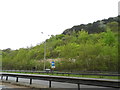
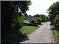
The A229, Kit's Coty
Going through a cutting on the North Downs
Image: © David Howard
Taken: 12 May 2013
0.07 miles
5
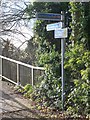
Sign for Australian Cyclist !!!
Near footbridge across A229 at Kit's Coty, near Chatham Road.
NOTE ..TOP MAIDSTONE SIGN.....
Image: © David Anstiss
Taken: 25 Nov 2008
0.07 miles
8
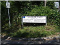
Sign at entrance to Salisbury Road, Kits Coty
Image: © Chris Whippet
Taken: 30 Jun 2009
0.07 miles
10
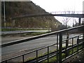
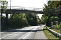
Footbridge over A229
At Kit's Coty near Chatham Road. Leads to Frith Wood and on to Walderslade.
A249 dual carriageway goes downhill to Maidstone/M20. Also goes uphill to Blue Bell Hill/M2/Chatham. North Downs Way (long distance path) does not use bridge but path on right to go down to Wouldham,then Maidstone.
Image: © David Anstiss
Taken: 25 Nov 2008
0.08 miles