IMAGES TAKEN NEAR TO
Kingswood Road, AYLESFORD, ME20 7EL
Introduction
This page details the photographs taken nearby to Kingswood Road, ME20 7EL by members of the Geograph project.
The Geograph project started in 2005 with the aim of publishing, organising and preserving representative images for every square kilometre of Great Britain, Ireland and the Isle of Man.

There are currently over 7.5m images from over14,400 individuals and you can help contribute to the project by visiting https://www.geograph.org.uk
Image Map
Images are licensed for reuse under creativecommons.org/licenses/by-sa/2.0
Notes
- Clicking on the map will re-center to the selected point.
- The higher the marker number, the further away the image location is from the centre of the postcode.
Image Listing (59 Images Found)
Images are licensed for reuse under creativecommons.org/licenses/by-sa/2.0
Image
Details
Distance
1
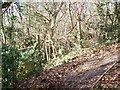
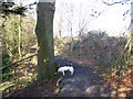
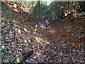
Not Centenary Walk Footpath
While on North Downs Way (long distance footpath) from Kit's Coty to Blue Bell Hill, near A229. Found footpath and steps heading downhill on lefthand side. Thought it was my path to Burham (not signed anything else). So went downhill but to my horror meet end of Kingswood Road in Kit's Coty. So had to return uphill to North Downs Way. Climbing up 100m in 30m of steps...
Shown on Explore Map 163 not on Landranger Map 178 or Maidstone and Medway Towns Street AZ Atlas (which I use for local footpaths).
Image: © David Anstiss
Taken: 25 Nov 2008
0.04 miles

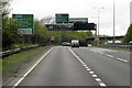
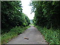
5
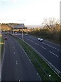
The A229 towards Maidstone
From Blue Bell Hill, Common Road.
Image: © David Anstiss
Taken: 28 Oct 2008
0.08 miles
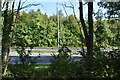
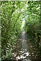
6
Maidstone Centenary Walk and North Downs Way Junction
On North Downs Way (long distance footpath) heading uphill from Kit's Coty to Blue Bell Hill, alongside A229. The Maidstone Centenary Walk crosses footpath from Blue Bell Hill downhill to Burham.
Image: © David Anstiss
Taken: 25 Nov 2008
0.09 miles
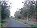
10
Maidstone Centenary Walk on the way up Blue Bell Hill
This is the view from the Maidstone Centenary Walk as it climbs up the North Downs through the woodland at Blue Bell Hill. For more information and pictures of the Maidstone Centenary Walk see http://www.bertuchi.co.uk/maidstone.php and http://www.bertuchi.co.uk/medwayvalley1.php This was a lovely clear autumn day.
Image: © Marathon
Taken: 10 Nov 2013
0.12 miles