IMAGES TAKEN NEAR TO
Lower Warren Road, AYLESFORD, ME20 7EH
Introduction
This page details the photographs taken nearby to Lower Warren Road, ME20 7EH by members of the Geograph project.
The Geograph project started in 2005 with the aim of publishing, organising and preserving representative images for every square kilometre of Great Britain, Ireland and the Isle of Man.

There are currently over 7.5m images from over14,400 individuals and you can help contribute to the project by visiting https://www.geograph.org.uk
Image Map
Images are licensed for reuse under creativecommons.org/licenses/by-sa/2.0
Notes
- Clicking on the map will re-center to the selected point.
- The higher the marker number, the further away the image location is from the centre of the postcode.
Image Listing (26 Images Found)
Images are licensed for reuse under creativecommons.org/licenses/by-sa/2.0
Image
Details
Distance
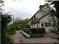
1
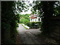
Lower Warren Road, near Blue Bell Hill
Image: © Chris Whippet
Taken: 12 Jun 2009
0.02 miles
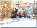
2
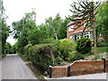
Lower Warren Road, near Blue Bell Hill
Image: © Chris Whippet
Taken: 12 Jun 2009
0.06 miles
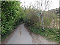
3
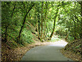
Sharp bend on Warren Road
A single track lane on a Roman route. Even this bend on a steep hill could well be Roman, as there is no way the Romans could have gone straight up Bluebell Hill.
Image: © Robin Webster
Taken: 23 Jun 2012
0.06 miles
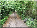
4
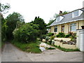
Lower Warren Road, near Blue Bell Hill
Image: © Chris Whippet
Taken: 12 Jun 2009
0.11 miles
5
Lower Warren Road, near Blue Bell Hill
Image: © Chris Whippet
Taken: 21 Apr 2017
0.12 miles
6
Lower Warren Road, near Blue Bell Hill
Image: © Chris Whippet
Taken: 19 Dec 2009
0.13 miles
7
Lower Warren Road, near Blue Bell Hill
Image: © Chris Whippet
Taken: 21 Apr 2017
0.14 miles
8
Lower Warren Road, near Blue Bell Hill
Image: © Chris Whippet
Taken: 12 Jun 2009
0.15 miles
9
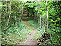
Steep woodland footpath near Blue Bell Hill
Image: © Chris Whippet
Taken: 12 Jun 2009
0.16 miles
10
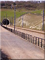
CTRL North Downs Tunnel in its setting
This is the southern portal of the two mile long North Downs Tunnel, cut through the chalk under Blue Bell Hill for the CTRL. The track on the left is a service road for the tunnel.
Image: © Kenneth Yarham
Taken: 16 Apr 2010
0.17 miles