IMAGES TAKEN NEAR TO
Pine Close, AYLESFORD, ME20 6NH
Introduction
This page details the photographs taken nearby to Pine Close, ME20 6NH by members of the Geograph project.
The Geograph project started in 2005 with the aim of publishing, organising and preserving representative images for every square kilometre of Great Britain, Ireland and the Isle of Man.

There are currently over 7.5m images from over14,400 individuals and you can help contribute to the project by visiting https://www.geograph.org.uk
Image Map
Images are licensed for reuse under creativecommons.org/licenses/by-sa/2.0
Notes
- Clicking on the map will re-center to the selected point.
- The higher the marker number, the further away the image location is from the centre of the postcode.
Image Listing (36 Images Found)
Images are licensed for reuse under creativecommons.org/licenses/by-sa/2.0
Image
Details
Distance
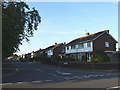
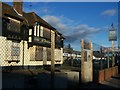
2
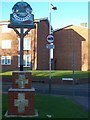
Larkfield Village Sign
On New Hythe Lane, on pavement in front of Larkfield Fire Station.
Image: © David Anstiss
Taken: 21 Dec 2008
0.11 miles
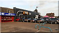
3

Larkfield fire station
Larkfield fire station, New Hythe Lane, Larkfield, Aylesford, Kent
Image: © Kevin Hale
Taken: 17 Oct 2007
0.11 miles
5
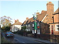
The Monkshead Pub, Larkfield
On 44 New Hythe Lane.
Image: © David Anstiss
Taken: 21 Dec 2008
0.16 miles
7
Arden (Maidstone) Mini Dealership
With attached Mini on the wall.
Image: © David Anstiss
Taken: 30 Dec 2017
0.17 miles
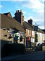
8
The Spotted Cow, Larkfield
Closed pub on A20 London Road.
Image: © David Anstiss
Taken: 21 Dec 2008
0.18 miles