IMAGES TAKEN NEAR TO
Kiln Barn Road, AYLESFORD, ME20 6AP
Introduction
This page details the photographs taken nearby to Kiln Barn Road, ME20 6AP by members of the Geograph project.
The Geograph project started in 2005 with the aim of publishing, organising and preserving representative images for every square kilometre of Great Britain, Ireland and the Isle of Man.

There are currently over 7.5m images from over14,400 individuals and you can help contribute to the project by visiting https://www.geograph.org.uk
Image Map
Images are licensed for reuse under creativecommons.org/licenses/by-sa/2.0
Notes
- Clicking on the map will re-center to the selected point.
- The higher the marker number, the further away the image location is from the centre of the postcode.
Image Listing (12 Images Found)
Images are licensed for reuse under creativecommons.org/licenses/by-sa/2.0
Image
Details
Distance
1
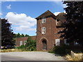
The Ditton Laboratory
More information: http://www.kenthistoryforum.co.uk/index.php?topic=6151.0
Image: © Chris Whippet
Taken: 4 Aug 2013
0.03 miles
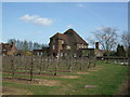
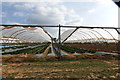
3
Former Laboratories on Kiln Barn Lane
Were once part of East Malling Horticultural Research Station.
Image: © David Anstiss
Taken: 27 Jan 2009
0.05 miles
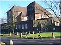
4
Laboratory Buildings of East Malling Research Station
On Kiln Barn Road, near East Malling. As of March 2009 the lower windows were all boarded up, so not sure what the future of this building is.
Image: © Sean Carter
Taken: 22 Mar 2009
0.07 miles
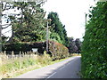
6
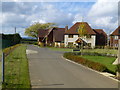
Cyril West Lane Ditton
A small group of houses in Kiln Barn Lane opposite the East Malling Research Centre
Image: © Ron Lee
Taken: 15 Oct 2016
0.10 miles
7
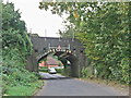
Rail bridge over Kiln Barn Road, near Ditton
Image: © Chris Whippet
Taken: 14 Oct 2010
0.21 miles
8
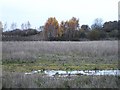
Quarry Wood industrial estate
There are still vacant plots on the far reaches of the estate but landscaping and tree planting (left) have already been done.
Image: © Penny Mayes
Taken: 5 Dec 2005
0.21 miles
9
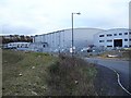
Quarry Wood industrial estate
A large and still expanding retail park / industrial estate in a disused quarry to the west of Maidstone.
Image: © Penny Mayes
Taken: 5 Dec 2005
0.21 miles
10
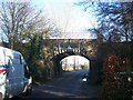
Railbridge over Kiln Barn Road
Called 'Bridge S93SBJ Cowbarn'. Kiln Barn Road leads under bridge to Ditton from East Malling. Railway heads left to East Malling from Barming.
Image: © David Anstiss
Taken: 27 Jan 2009
0.24 miles