IMAGES TAKEN NEAR TO
Sandy Lane, WEST MALLING, ME19 6TG

Introduction

This page details the photographs taken nearby to Sandy Lane, ME19 6TG by members of the Geograph project.

The Geograph project started in 2005 with the aim of publishing, organising and preserving representative images for every square kilometre of Great Britain, Ireland and the Isle of Man.

There are currently over 7.5m images from over14,400 individuals and you can help contribute to the project by visiting https://www.geograph.org.uk

Image Map


Images are licensed for reuse under creativecommons.org/licenses/by-sa/2.0
Notes
  • Clicking on the map will re-center to the selected point.
  • The higher the marker number, the further away the image location is from the centre of the postcode.

Image Listing (10 Images Found)

Images are licensed for reuse under creativecommons.org/licenses/by-sa/2.0
Image
Details
Distance
1
Railway Bridge
A railway bridge over a narrow country road.
Image: © Hywel Williams Taken: 27 Jun 2005
0.05 miles
2
Addington car boot sale, Kent
Image: © Francois Thomas Taken: 7 Apr 2007
0.10 miles
3
Sandy Lane, West Malling
The very narrow Sandy Lane leads out from West Malling, past the village hall which is on the left here, to reach the A20. This is right on the edge of the built-up area of West Malling.
Image: © Marathon Taken: 1 May 2016
0.13 miles
4
Sandy Lane, West Malling
The very narrow Sandy Lane leads out from West Malling, past the village hall to reach the A20. This is right on the edge of the built-up area of West Malling.
Image: © Marathon Taken: 1 May 2016
0.14 miles
5
Sandy Lane
Turning off the A20 onto a narrow winding lane, immediately the speed limit is relaxed - so logical!
Image: © Robin Webster Taken: 9 Jun 2012
0.14 miles
6
The A20, West Malling
Image: © David Howard Taken: 8 May 2016
0.18 miles
7
Fields by the A20, West Malling
Image: © David Howard Taken: 8 May 2016
0.18 miles
8
Houses on London Road, A20
Opposite the end of Roughetts Road.
Image: © Robin Webster Taken: 9 Jun 2012
0.19 miles
9
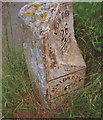
Old Milestone by the A20, London Road, Ryarsh parish
Metal plate attached to stone post by the A20, in parish of RYARSH (TONBRIDGE AND MALLING District), London Road, junction with Roughetts Road, East of bus stop, on the verge between road and path, on North side of road. Kent hipped iron plate, erected by the Wrotham & Maidstone turnpike trust in the 19th century. Inscription reads:- : MAIDSTONE / 6 : : TO / LONDON / 28 / --- / Ryarsh : : WROTHAM / 4 : Grade II listed. List Entry Number: 1363151 https://historicengland.org.uk/listing/the-list/list-entry/1363151 Milestone Society National ID: KE_LF28.
Image: © C Woodward Taken: 11 Jun 2008
0.22 miles
10
Lots of lettuces
Church Farm is one of the largest vegetable farms in the area, specialising in lettuce.
Image: © N Chadwick Taken: 10 Jul 2010
0.25 miles