IMAGES TAKEN NEAR TO
The Links, WEST MALLING, ME19 5RX
Introduction
This page details the photographs taken nearby to The Links, ME19 5RX by members of the Geograph project.
The Geograph project started in 2005 with the aim of publishing, organising and preserving representative images for every square kilometre of Great Britain, Ireland and the Isle of Man.

There are currently over 7.5m images from over14,400 individuals and you can help contribute to the project by visiting https://www.geograph.org.uk
Image Map
Images are licensed for reuse under creativecommons.org/licenses/by-sa/2.0
Notes
- Clicking on the map will re-center to the selected point.
- The higher the marker number, the further away the image location is from the centre of the postcode.
Image Listing (18 Images Found)
Images are licensed for reuse under creativecommons.org/licenses/by-sa/2.0
Image
Details
Distance
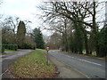
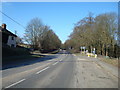
2
Church Road at the junction of the A20
Image: © David Howard
Taken: 12 May 2013
0.08 miles
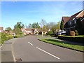
5
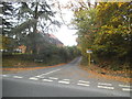
East Street at the junction of Trottiscliffe Road
Image: © David Howard
Taken: 30 Oct 2016
0.12 miles
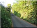
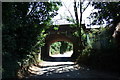
7
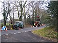
Tree cutting on Trottiscliffe Road
Trees along this short length of road in Addington are being trimmed back. Behind green landrover,is a guy with chainsaw in a harness in a tree.
Image: © David Anstiss
Taken: 17 Feb 2009
0.14 miles
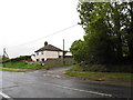
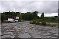
8
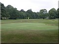
West Malling Golf Club
A green on West Malling Golf Club, which occupies the majority of the land on this square.
Image: © Hywel Williams
Taken: 25 Jun 2005
0.15 miles