IMAGES TAKEN NEAR TO
Bridgewater Place, WEST MALLING, ME19 5QN
Introduction
This page details the photographs taken nearby to Bridgewater Place, ME19 5QN by members of the Geograph project.
The Geograph project started in 2005 with the aim of publishing, organising and preserving representative images for every square kilometre of Great Britain, Ireland and the Isle of Man.

There are currently over 7.5m images from over14,400 individuals and you can help contribute to the project by visiting https://www.geograph.org.uk
Image Map
Images are licensed for reuse under creativecommons.org/licenses/by-sa/2.0
Notes
- Clicking on the map will re-center to the selected point.
- The higher the marker number, the further away the image location is from the centre of the postcode.
Image Listing (77 Images Found)
Images are licensed for reuse under creativecommons.org/licenses/by-sa/2.0
Image
Details
Distance
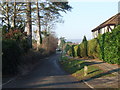
3
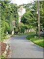
North Rectory Lane, Leybourne
The tower of St Peter and St Paul's church can be seen at the end of North Rectory Lane.
Image: © Philip Halling
Taken: 11 Aug 2021
0.17 miles
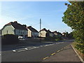
4
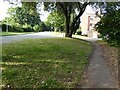
Oxley Shaw Lane, Leybourne
Path beside Oxley Shaw Lane in a residential housing estate in Leybourne.
Image: © Philip Halling
Taken: 11 Aug 2021
0.19 miles
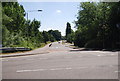
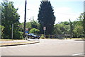
6
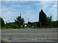
Traffic Calming, Castle Way, Leybourne
The old route of the A228, before the by-pass.
Image: © N Chadwick
Taken: 10 Jul 2010
0.21 miles
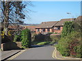
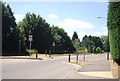
7
Looking from St. Peter & St. Paul , Leybourne across to Rectory Lane
Image: © Basher Eyre
Taken: 2 Jun 2012
0.22 miles
8
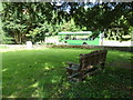
St. Peter & St. Paul , Leybourne: churchyard (6)
Image: © Basher Eyre
Taken: 2 Jun 2012
0.22 miles