IMAGES TAKEN NEAR TO
Malling Road, MAIDSTONE, ME18 5BH
Introduction
This page details the photographs taken nearby to Malling Road, ME18 5BH by members of the Geograph project.
The Geograph project started in 2005 with the aim of publishing, organising and preserving representative images for every square kilometre of Great Britain, Ireland and the Isle of Man.

There are currently over 7.5m images from over14,400 individuals and you can help contribute to the project by visiting https://www.geograph.org.uk
Image Map
Images are licensed for reuse under creativecommons.org/licenses/by-sa/2.0
Notes
- Clicking on the map will re-center to the selected point.
- The higher the marker number, the further away the image location is from the centre of the postcode.
Image Listing (23 Images Found)
Images are licensed for reuse under creativecommons.org/licenses/by-sa/2.0
Image
Details
Distance
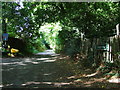
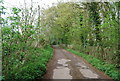
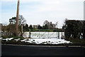
1
Livesey Street, Teston
Despite the name, this "street" is a stone-surfaced, dead-end track serving just a few properties. It is shown on the Explorer map with the green dot symbol indicating "other road with public access" and is certainly used as a bridleway.
Image: © Stephen Craven
Taken: 22 Mar 2009
0.03 miles
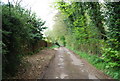
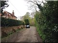
7
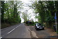
Malling Rd & Livesey St junction north of Teston
Image: © N Chadwick
Taken: 13 Apr 2009
0.07 miles