IMAGES TAKEN NEAR TO
St. Lawrence Crescent, MAIDSTONE, ME17 4FR
Introduction
This page details the photographs taken nearby to St. Lawrence Crescent, ME17 4FR by members of the Geograph project.
The Geograph project started in 2005 with the aim of publishing, organising and preserving representative images for every square kilometre of Great Britain, Ireland and the Isle of Man.

There are currently over 7.5m images from over14,400 individuals and you can help contribute to the project by visiting https://www.geograph.org.uk
Image Map
Images are licensed for reuse under creativecommons.org/licenses/by-sa/2.0
Notes
- Clicking on the map will re-center to the selected point.
- The higher the marker number, the further away the image location is from the centre of the postcode.
Image Listing (50 Images Found)
Images are licensed for reuse under creativecommons.org/licenses/by-sa/2.0
Image
Details
Distance
1
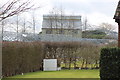
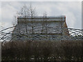
The Oast, Clockhouse Farm, Heath Road, Coxheath
Image: © Oast House Archive
Taken: 22 Feb 2015
0.05 miles
2
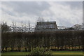
The Oast, Clockhouse Farm, Heath Road, Coxheath
Image: © Oast House Archive
Taken: 22 Feb 2015
0.05 miles
3
The Oast, Clockhouse Farm, Heath Road, Coxheath
Image: © Oast House Archive
Taken: 22 Feb 2015
0.05 miles
4
The Oast, Clockhouse Farm, Heath Road, Coxheath
Image: © Oast House Archive
Taken: 22 Feb 2015
0.05 miles
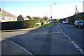
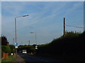
8

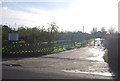
Speed inhibitors, Coxheath
Various signs plus one of several chicanes are ahead, they may cause a speed reduction, but could the distraction they cause be counter-productive to road safety?
Image: © Robin Webster
Taken: 9 Jul 2012
0.08 miles