IMAGES TAKEN NEAR TO
Stilebridge Lane, MAIDSTONE, ME17 4DE
Introduction
This page details the photographs taken nearby to Stilebridge Lane, ME17 4DE by members of the Geograph project.
The Geograph project started in 2005 with the aim of publishing, organising and preserving representative images for every square kilometre of Great Britain, Ireland and the Isle of Man.

There are currently over 7.5m images from over14,400 individuals and you can help contribute to the project by visiting https://www.geograph.org.uk
Image Map
Images are licensed for reuse under creativecommons.org/licenses/by-sa/2.0
Notes
- Clicking on the map will re-center to the selected point.
- The higher the marker number, the further away the image location is from the centre of the postcode.
Image Listing (11 Images Found)
Images are licensed for reuse under creativecommons.org/licenses/by-sa/2.0
Image
Details
Distance
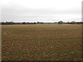
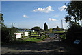
1
Fields just outside Boughton Monchelsea
Image: © Lisa Fulcher
Taken: 9 Dec 2006
0.06 miles
2
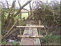
Footbridge over Stream
On footpath from Charlton Farm, Lower Farm Road to Staplehurst Road, A229.
Stream leads to River Beult from Darnold Wood.
Image: © David Anstiss
Taken: 13 Mar 2009
0.18 miles
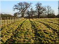
3
White House Farm, Stilebridge Lane, Linton, Kent
Image: © Oast House Archive
Taken: 9 Oct 2008
0.19 miles

5
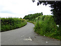
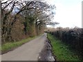
Stilebridge Lane
Heading towards the A229.
Image: © Robin Webster
Taken: 22 Jun 2016
0.21 miles
7
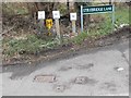
Water access points and signs, Stilebridge Lane
The yellow sign with H denotes a fire hydrant. The white sign with SV denotes (I think) either a safety valve or stop valve but I am willing to stand corrected. The four metal hatches in the road are the features referred to in the signs. When actually standing nearby, it is possible to see H and SV markings on the hatches too.
Image: © Danny P Robinson
Taken: 24 Feb 2013
0.23 miles
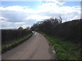
8
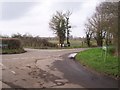
Road junction on Church Hill
Church Hill road from Boughton Monchelsea stops here. Road opposite is Stilebridge Lane leading to Marden. Road heading left is Lower Farm Road to Rabbits Cross. Road heading right is Butt Green Lane to Linton.
Image: © David Anstiss
Taken: 13 Mar 2009
0.24 miles