IMAGES TAKEN NEAR TO
Chartway Street, MAIDSTONE, ME17 3HZ
Introduction
This page details the photographs taken nearby to Chartway Street, ME17 3HZ by members of the Geograph project.
The Geograph project started in 2005 with the aim of publishing, organising and preserving representative images for every square kilometre of Great Britain, Ireland and the Isle of Man.

There are currently over 7.5m images from over14,400 individuals and you can help contribute to the project by visiting https://www.geograph.org.uk
Image Map
Images are licensed for reuse under creativecommons.org/licenses/by-sa/2.0
Notes
- Clicking on the map will re-center to the selected point.
- The higher the marker number, the further away the image location is from the centre of the postcode.
Image Listing (7 Images Found)
Images are licensed for reuse under creativecommons.org/licenses/by-sa/2.0
Image
Details
Distance
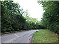
3
Pleasure House Lane, near Sutton Valence
Image: © Chris Whippet
Taken: 14 Sep 2013
0.14 miles
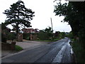
4
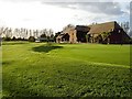
The Ridge Golf Club
On the south side of Chartway Street near the southern edge of the square.
Image: © Penny Mayes
Taken: 20 Oct 2005
0.16 miles
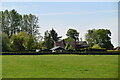
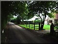
6

Runner beans, Summerwood Farm
On the south side of Pitt Road just south of the centre of the square.
Image: © Penny Mayes
Taken: 20 Oct 2005
0.20 miles