IMAGES TAKEN NEAR TO
Sutton Valence Hill, MAIDSTONE, ME17 3AR
Introduction
This page details the photographs taken nearby to Sutton Valence Hill, ME17 3AR by members of the Geograph project.
The Geograph project started in 2005 with the aim of publishing, organising and preserving representative images for every square kilometre of Great Britain, Ireland and the Isle of Man.

There are currently over 7.5m images from over14,400 individuals and you can help contribute to the project by visiting https://www.geograph.org.uk
Image Map
Images are licensed for reuse under creativecommons.org/licenses/by-sa/2.0
Notes
- Clicking on the map will re-center to the selected point.
- The higher the marker number, the further away the image location is from the centre of the postcode.
Image Listing (150 Images Found)
Images are licensed for reuse under creativecommons.org/licenses/by-sa/2.0
Image
Details
Distance
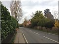
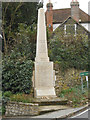
3
Oast House, Headcorn Road, Sutton Valance, Kent
Image: © Oast House Archive
Taken: 23 Sep 2007
0.06 miles
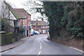
4
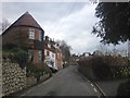
Houses on Chart Road, Sutton Valence, Kent
Image: © Oast House Archive
Taken: 3 Sep 2008
0.07 miles
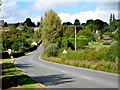
9
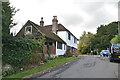
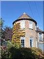
![Sutton Valence houses [12]](https://s1.geograph.org.uk/geophotos/07/07/92/7079229_4464603e_120x120.jpg)
Sutton Valence houses [12]
Hillside House, Headcorn Road, was built in the 17th century. Timber framed with the ground floor rebuilt in red brick, the first floor tile hung, all under a tile roof. Some 17th century panelling remains inside. Listed, grade II, with details at: https://historicengland.org.uk/listing/the-list/list-entry/1052252
Sutton Valence is a village 5¼ miles southeast of Maidstone and about 13 miles northwest of Ashford. The area was settled in the Iron Age and a Roman road passes through. Known as Sutton until the manor became the property of William de Valence, The village is home to a castle, now ruinous, built in the late 12th century and one of the oldest schools in England, founded in 1576 as a Free Grammar School.
Image: © Michael Dibb
Taken: 11 Sep 2021
0.09 miles
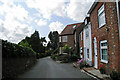
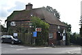
10
Former oast house in Sutton Valence
This house is immediately east of the churchyard at Sutton Valence. It has every appearance of having once been an oast house.
Image: © Marathon
Taken: 15 Sep 2019
0.09 miles