IMAGES TAKEN NEAR TO
Waterditch Lane, MAIDSTONE, ME17 2DY
Introduction
This page details the photographs taken nearby to Waterditch Lane, ME17 2DY by members of the Geograph project.
The Geograph project started in 2005 with the aim of publishing, organising and preserving representative images for every square kilometre of Great Britain, Ireland and the Isle of Man.

There are currently over 7.5m images from over14,400 individuals and you can help contribute to the project by visiting https://www.geograph.org.uk
Image Map
Images are licensed for reuse under creativecommons.org/licenses/by-sa/2.0
Notes
- Clicking on the map will re-center to the selected point.
- The higher the marker number, the further away the image location is from the centre of the postcode.
Image Listing (10 Images Found)
Images are licensed for reuse under creativecommons.org/licenses/by-sa/2.0
Image
Details
Distance
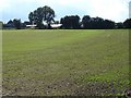
1
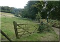
Byway by Waterditch Farm
The path runs between Waterditch Road and the North Downs Way.
Image: © pam fray
Taken: 14 Oct 2021
0.02 miles
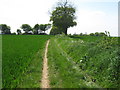
2
Waterditch Farm
The byway which runs down beside the farmhouse joins up with the North Downs Way in Image The crop awaiting harvest is wheat.
Image: © Penny Mayes
Taken: 1 Aug 2006
0.03 miles
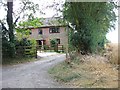
3

Waterditch Farm Barn
On byway from Waterditch Lane. Byway passes farm and barn leading to North Downs Way (a long distance footpath).
Image: © David Anstiss
Taken: 10 May 2009
0.03 miles
4
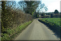
Waterditch Road
Towards Waterditch Farm.
Image: © Robin Webster
Taken: 30 Jan 2018
0.04 miles
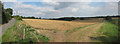
6
Winter wheat
Westbury farm beyond the hedge.
Image: © Penny Mayes
Taken: 26 Sep 2006
0.11 miles
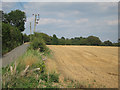
7
Byway from Waterditch Farm
This byway leads to another byway used by the North Downs Way (long distance footpath).
Image: © David Anstiss
Taken: 10 May 2009
0.11 miles
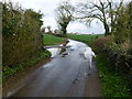
8
Field off Cold Harbour Road
Recently harvest wheat field.
Image: © Oast House Archive
Taken: 19 Aug 2011
0.19 miles
9
Field off Cold Harbour Road
Recently harvest wheat field.
Image: © Oast House Archive
Taken: 19 Aug 2011
0.20 miles
10
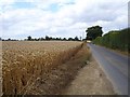
Wheat on Waterditch Road
Looking NW towards the Warren Street water tower http://www.geograph.org.uk/photo/187582
Image: © Penny Mayes
Taken: 1 Aug 2006
0.23 miles