IMAGES TAKEN NEAR TO
Forge Lane, MAIDSTONE, ME17 1RT
Introduction
This page details the photographs taken nearby to Forge Lane, ME17 1RT by members of the Geograph project.
The Geograph project started in 2005 with the aim of publishing, organising and preserving representative images for every square kilometre of Great Britain, Ireland and the Isle of Man.

There are currently over 7.5m images from over14,400 individuals and you can help contribute to the project by visiting https://www.geograph.org.uk
Image Map
Images are licensed for reuse under creativecommons.org/licenses/by-sa/2.0
Notes
- Clicking on the map will re-center to the selected point.
- The higher the marker number, the further away the image location is from the centre of the postcode.
Image Listing (22 Images Found)
Images are licensed for reuse under creativecommons.org/licenses/by-sa/2.0
Image
Details
Distance
1
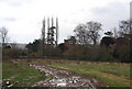
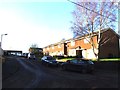
Brogden Farm Oast, Forge Lane, Leeds, Kent
Image: © Oast House Archive
Taken: 29 Jun 2009
0.02 miles
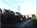
3
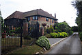
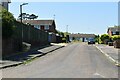
House at Brogden, Forge Lane, Leeds, Kent
Image: © Oast House Archive
Taken: 21 Sep 2008
0.03 miles
4
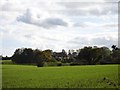
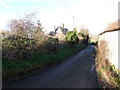
Brogden
Looking south from Old Mill Road.
Image: © Penny Mayes
Taken: 20 Oct 2005
0.06 miles
9
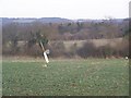
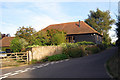
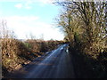
Small windmill in field
This natural spinning birdscarer and spinning shiny ball birdscarer (on far left) stop birds from ruining this crop of Oil Seed Rape. Nearby farms use gas powered gun blasts.
Image: © David Anstiss
Taken: 26 Feb 2009
0.21 miles