IMAGES TAKEN NEAR TO
Penfold Hill, MAIDSTONE, ME17 1RQ
Introduction
This page details the photographs taken nearby to Penfold Hill, ME17 1RQ by members of the Geograph project.
The Geograph project started in 2005 with the aim of publishing, organising and preserving representative images for every square kilometre of Great Britain, Ireland and the Isle of Man.

There are currently over 7.5m images from over14,400 individuals and you can help contribute to the project by visiting https://www.geograph.org.uk
Image Map
Images are licensed for reuse under creativecommons.org/licenses/by-sa/2.0
Notes
- Clicking on the map will re-center to the selected point.
- The higher the marker number, the further away the image location is from the centre of the postcode.
Image Listing (86 Images Found)
Images are licensed for reuse under creativecommons.org/licenses/by-sa/2.0
Image
Details
Distance
4
Entrance to Leeds Water Treatment Works
Off Penfold Lane.
Image: © Danny P Robinson
Taken: 25 Jun 2013
0.08 miles
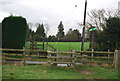
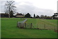
6
Footpath crosses Burberry Lane
A footpath leads from Leeds Church/Church Carpark through field, then over road into the grounds of Leeds Castle and then onto Broomfield Road.
Image: © David Anstiss
Taken: 26 Feb 2009
0.11 miles
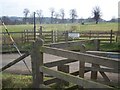
10
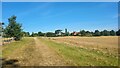
Public Footpath view towards Ashbank
Footpath that does close during major events at Leeds Castle.
Image: © James Emmans
Taken: 6 Aug 2022
0.13 miles