IMAGES TAKEN NEAR TO
Upper Fant Road, MAIDSTONE, ME16 8DH
Introduction
This page details the photographs taken nearby to Upper Fant Road, ME16 8DH by members of the Geograph project.
The Geograph project started in 2005 with the aim of publishing, organising and preserving representative images for every square kilometre of Great Britain, Ireland and the Isle of Man.

There are currently over 7.5m images from over14,400 individuals and you can help contribute to the project by visiting https://www.geograph.org.uk
Image Map
Images are licensed for reuse under creativecommons.org/licenses/by-sa/2.0
Notes
- Clicking on the map will re-center to the selected point.
- The higher the marker number, the further away the image location is from the centre of the postcode.
Image Listing (40 Images Found)
Images are licensed for reuse under creativecommons.org/licenses/by-sa/2.0
Image
Details
Distance
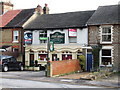
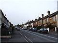
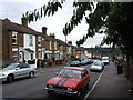
1
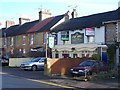
The Frant Arms Pub, Maidstone
On 224 Upper Frant Road, nearly opposite Whitmore Street.
Image: © David Anstiss
Taken: 21 Jan 2009
0.03 miles
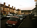
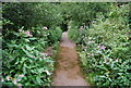
4
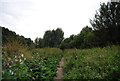
Clare Park
Accessed from either A26 Tonbridge Road or (this view) from Upper Frant Road. Popular with dog walkers and kids with football.
Image: © David Anstiss
Taken: 21 Jan 2009
0.08 miles
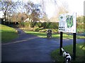
6
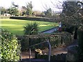
Bowling Green and Pavilion
In Clare Park, on A26 Tonbridge Road.
Image: © David Anstiss
Taken: 21 Jan 2009
0.09 miles
10
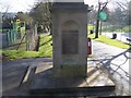
Drinking Water Fountain in Clare Park
Near A26 Tonbridge Road entrance.
Has dedication plaque on it.
Image: © David Anstiss
Taken: 21 Jan 2009
0.13 miles