IMAGES TAKEN NEAR TO
Marigold Way, MAIDSTONE, ME16 0ZF
Introduction
This page details the photographs taken nearby to Marigold Way, ME16 0ZF by members of the Geograph project.
The Geograph project started in 2005 with the aim of publishing, organising and preserving representative images for every square kilometre of Great Britain, Ireland and the Isle of Man.

There are currently over 7.5m images from over14,400 individuals and you can help contribute to the project by visiting https://www.geograph.org.uk
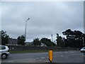
Image Map
Images are licensed for reuse under creativecommons.org/licenses/by-sa/2.0
Notes
- Clicking on the map will re-center to the selected point.
- The higher the marker number, the further away the image location is from the centre of the postcode.
Image Listing (56 Images Found)
Images are licensed for reuse under creativecommons.org/licenses/by-sa/2.0
Image
Details
Distance
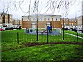
6
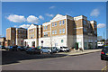
Apartments off Marigold Way
Built around 2006, the building has shops and businesses at ground floor and apartments above.
Image: © Oast House Archive
Taken: 23 Mar 2011
0.08 miles
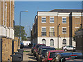
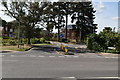
7
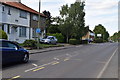
Hermitage Road, Barming
At the end of Oakapple Lane
Image: © David Howard
Taken: 19 Jun 2016
0.08 miles
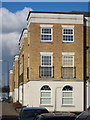
10
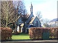
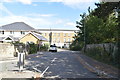
Converted Church within Former Hospital Grounds
Unnamed church, now converted into 'Queen's House' 1-7 Apartments.
Image: © David Anstiss
Taken: 21 Jan 2009
0.09 miles