IMAGES TAKEN NEAR TO
Felderland Drive, MAIDSTONE, ME15 9YB
Introduction
This page details the photographs taken nearby to Felderland Drive, ME15 9YB by members of the Geograph project.
The Geograph project started in 2005 with the aim of publishing, organising and preserving representative images for every square kilometre of Great Britain, Ireland and the Isle of Man.

There are currently over 7.5m images from over14,400 individuals and you can help contribute to the project by visiting https://www.geograph.org.uk
Image Map
Images are licensed for reuse under creativecommons.org/licenses/by-sa/2.0
Notes
- Clicking on the map will re-center to the selected point.
- The higher the marker number, the further away the image location is from the centre of the postcode.
Image Listing (41 Images Found)
Images are licensed for reuse under creativecommons.org/licenses/by-sa/2.0
Image
Details
Distance
6
Thomas Rider Way, Boughton Monchelsea
Image: © Chris Whippet
Taken: 26 Feb 2016
0.07 miles
10
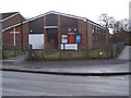
Christ Church, Park Wood
On junction of Wallis Avenue (on left) and Wrangleden Lane (on right). In the Diocese of Canterbury.
Image: © David Anstiss
Taken: 20 Jan 2009
0.11 miles