IMAGES TAKEN NEAR TO
Otham Street, MAIDSTONE, ME15 8RW
Introduction
This page details the photographs taken nearby to Otham Street, ME15 8RW by members of the Geograph project.
The Geograph project started in 2005 with the aim of publishing, organising and preserving representative images for every square kilometre of Great Britain, Ireland and the Isle of Man.

There are currently over 7.5m images from over14,400 individuals and you can help contribute to the project by visiting https://www.geograph.org.uk
Image Map
Images are licensed for reuse under creativecommons.org/licenses/by-sa/2.0
Notes
- Clicking on the map will re-center to the selected point.
- The higher the marker number, the further away the image location is from the centre of the postcode.
Image Listing (86 Images Found)
Images are licensed for reuse under creativecommons.org/licenses/by-sa/2.0
Image
Details
Distance
3
![Otham houses [4]](https://s0.geograph.org.uk/geophotos/07/07/77/7077780_c2edb684_120x120.jpg)
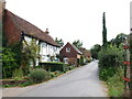
Otham houses [4]
Otham Manor, Otham Street, is a late 14th century Wealden type house with two halls. A rear wing was added in the 16th century and the house was subdivided into cottages. Restored and added to circa 1912. Timber framed, plaster infill, all under a tile roof. Listed, grade I, with details at: https://historicengland.org.uk/listing/the-list/list-entry/1250941
Otham is a small, widely spread village, on the southeastern edge of Maidstone, some 2¾ miles from the town centre and 15 miles northwest of Ashford. There are plans to add another 1250 houses to the village which currently has 204 dwellings.
Image: © Michael Dibb
Taken: 11 Sep 2021
0.08 miles


7
![Otham houses [3]](https://s2.geograph.org.uk/geophotos/07/07/77/7077770_274a0a0d_120x120.jpg)
Otham houses [3]
The Old School in Otham Street was built in 1851.
Otham is a small, widely spread village, on the southeastern edge of Maidstone, some 2¾ miles from the town centre and 15 miles northwest of Ashford. There are plans to add another 1250 houses to the village which currently has 204 dwellings.
Image: © Michael Dibb
Taken: 11 Sep 2021
0.11 miles


10

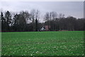
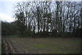
War memorial, Otham
with adjacent children's play area under the trees.
Image: © Penny Mayes
Taken: 14 Nov 2005
0.12 miles