IMAGES TAKEN NEAR TO
Egremont Road, MAIDSTONE, ME15 8LH
Introduction
This page details the photographs taken nearby to Egremont Road, ME15 8LH by members of the Geograph project.
The Geograph project started in 2005 with the aim of publishing, organising and preserving representative images for every square kilometre of Great Britain, Ireland and the Isle of Man.

There are currently over 7.5m images from over14,400 individuals and you can help contribute to the project by visiting https://www.geograph.org.uk
Image Map
Images are licensed for reuse under creativecommons.org/licenses/by-sa/2.0
Notes
- Clicking on the map will re-center to the selected point.
- The higher the marker number, the further away the image location is from the centre of the postcode.
Image Listing (38 Images Found)
Images are licensed for reuse under creativecommons.org/licenses/by-sa/2.0
Image
Details
Distance
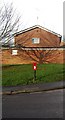
1
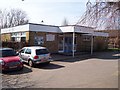
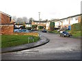
Madginford Library
On access road from Egremont Road. Building on right is Madginford Village Hall.
Image: © David Anstiss
Taken: 18 Mar 2009
0.03 miles
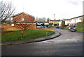
3
Greensand Rd off Spot Lane
Many of the roads on this estate are named after rocks there is Gault close & Ragstone close leading off Greensand road.
Image: © N Chadwick
Taken: 29 Nov 2009
0.15 miles
7
Postbox by the junction of Spot Lane & Greensand Rd
Image: © N Chadwick
Taken: 29 Nov 2009
0.17 miles