IMAGES TAKEN NEAR TO
Willington Street, MAIDSTONE, ME15 8JW
Introduction
This page details the photographs taken nearby to Willington Street, ME15 8JW by members of the Geograph project.
The Geograph project started in 2005 with the aim of publishing, organising and preserving representative images for every square kilometre of Great Britain, Ireland and the Isle of Man.

There are currently over 7.5m images from over14,400 individuals and you can help contribute to the project by visiting https://www.geograph.org.uk
Image Map
Images are licensed for reuse under creativecommons.org/licenses/by-sa/2.0
Notes
- Clicking on the map will re-center to the selected point.
- The higher the marker number, the further away the image location is from the centre of the postcode.
Image Listing (15 Images Found)
Images are licensed for reuse under creativecommons.org/licenses/by-sa/2.0
Image
Details
Distance
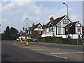
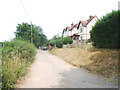
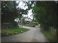
2
Willington Court, Bearsted
Listed building in Bearsted: http://www.britishlistedbuildings.co.uk/en-422231-willington-court-bearsted-kent
Image: © Chris Whippet
Taken: 14 Jul 2013
0.05 miles
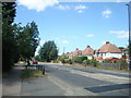
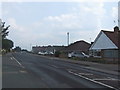
3
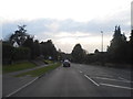
The A20 in Bearsted
Bearsted is a suburb on the eastern fringe of Maidstone including a station
Image: © David Howard
Taken: 21 Apr 2013
0.06 miles
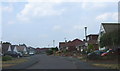
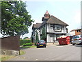
4
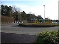
Park & Ride
Willington Street, Bearsted on the NE edge of Mote Park
Image: © Penny Mayes
Taken: 15 Dec 2005
0.08 miles