IMAGES TAKEN NEAR TO
Vinters Road, MAIDSTONE, ME14 5XD
Introduction
This page details the photographs taken nearby to Vinters Road, ME14 5XD by members of the Geograph project.
The Geograph project started in 2005 with the aim of publishing, organising and preserving representative images for every square kilometre of Great Britain, Ireland and the Isle of Man.

There are currently over 7.5m images from over14,400 individuals and you can help contribute to the project by visiting https://www.geograph.org.uk
Image Map
Images are licensed for reuse under creativecommons.org/licenses/by-sa/2.0
Notes
- Clicking on the map will re-center to the selected point.
- The higher the marker number, the further away the image location is from the centre of the postcode.
Image Listing (84 Images Found)
Images are licensed for reuse under creativecommons.org/licenses/by-sa/2.0
Image
Details
Distance
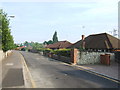
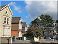
3
Queen Anne Road, ME14
Shows the location of Image
Image: © Mike Quinn
Taken: 27 Sep 2012
0.07 miles
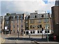
4
Queen Anne Road / Albion Place, ME14 (2)
Shows the location of Image
Image: © Mike Quinn
Taken: 27 Sep 2012
0.08 miles
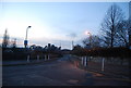
6
Queen Anne Road / Albion Place, ME14
Shows the location of Image
Image: © Mike Quinn
Taken: 27 Sep 2012
0.09 miles
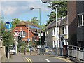
8
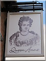
Sign for The Queen Anne, Union Street / Sittingbourne Road, ME14
See Image
Image: © Mike Quinn
Taken: 27 Sep 2012
0.10 miles
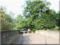
9
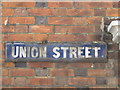
Old sign for Union Street
It's on the north wall of Image
Image: © Mike Quinn
Taken: 27 Sep 2012
0.10 miles
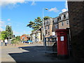
10
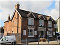
The Queen Anne, Union Street / Sittingbourne Road, ME14
Image: © Mike Quinn
Taken: 27 Sep 2012
0.10 miles