IMAGES TAKEN NEAR TO
Sittingbourne Road, MAIDSTONE, ME14 5ET
Introduction
This page details the photographs taken nearby to Sittingbourne Road, ME14 5ET by members of the Geograph project.
The Geograph project started in 2005 with the aim of publishing, organising and preserving representative images for every square kilometre of Great Britain, Ireland and the Isle of Man.

There are currently over 7.5m images from over14,400 individuals and you can help contribute to the project by visiting https://www.geograph.org.uk
Image Map
Images are licensed for reuse under creativecommons.org/licenses/by-sa/2.0
Notes
- Clicking on the map will re-center to the selected point.
- The higher the marker number, the further away the image location is from the centre of the postcode.
Image Listing (63 Images Found)
Images are licensed for reuse under creativecommons.org/licenses/by-sa/2.0
Image
Details
Distance
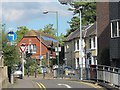
1
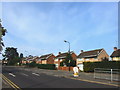
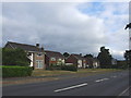
A249 Sttingbourne Road, Vinters Park, Maidstone
Image: © Chris Whippet
Taken: 14 Jul 2013
0.02 miles
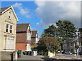
2
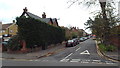
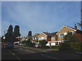
St. Luke's Avenue, Maidstone
St. Luke's Avenue is a residential road close to the centre of Maidstone.
Image: © Malc McDonald
Taken: 2 Nov 2013
0.05 miles
3
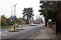
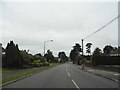
Sittingbourne Road, Maidstone, Kent
Image: © Oast House Archive
Taken: 15 Dec 2008
0.07 miles
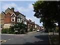
9
Queen Anne Road, ME14
Shows the location of Image
Image: © Mike Quinn
Taken: 27 Sep 2012
0.12 miles
10
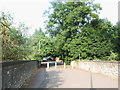
Union Street / Sittingbourne Road, ME14
Image: © Mike Quinn
Taken: 27 Sep 2012
0.12 miles