IMAGES TAKEN NEAR TO
Caring Lane, MAIDSTONE, ME14 4NJ
Introduction
This page details the photographs taken nearby to Caring Lane, ME14 4NJ by members of the Geograph project.
The Geograph project started in 2005 with the aim of publishing, organising and preserving representative images for every square kilometre of Great Britain, Ireland and the Isle of Man.

There are currently over 7.5m images from over14,400 individuals and you can help contribute to the project by visiting https://www.geograph.org.uk
Image Map
Images are licensed for reuse under creativecommons.org/licenses/by-sa/2.0
Notes
- Clicking on the map will re-center to the selected point.
- The higher the marker number, the further away the image location is from the centre of the postcode.
Image Listing (17 Images Found)
Images are licensed for reuse under creativecommons.org/licenses/by-sa/2.0
Image
Details
Distance
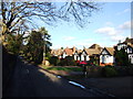
3
Bungalows in Caring Lane
The northern end of Caring Lane up to its junction with the A20 Ashford Road has a row of near identical bungalows.
Image: © Penny Mayes
Taken: 14 Nov 2005
0.07 miles
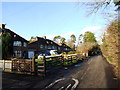
5
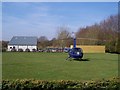
Corbin Business Park and helicopter
Base of GForces Web Management company on Caring Road. Unusual form of commuter transport.
See http://www.gforces.co.uk/ for more details.
Image: © David Anstiss
Taken: 18 Mar 2009
0.16 miles
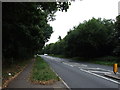
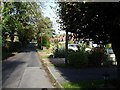
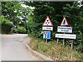
7
Truncated trees
By the A20 opposite the end of Caring Lane.
Image: © Robin Webster
Taken: 16 Feb 2014
0.20 miles
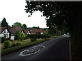
8
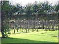
Bearsted Vineyard
On the west side of Caring Lane.
Image: © Penny Mayes
Taken: 14 Nov 2005
0.21 miles
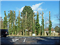
10
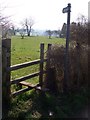
Stile on Caring Road
Footpath leads from stile, through field to next stile, past Oast Flat to Fulling Mill Farm on River Len.
Image: © David Anstiss
Taken: 18 Mar 2009
0.22 miles