IMAGES TAKEN NEAR TO
Roundwell, MAIDSTONE, ME14 4EU
Introduction
This page details the photographs taken nearby to Roundwell, ME14 4EU by members of the Geograph project.
The Geograph project started in 2005 with the aim of publishing, organising and preserving representative images for every square kilometre of Great Britain, Ireland and the Isle of Man.

There are currently over 7.5m images from over14,400 individuals and you can help contribute to the project by visiting https://www.geograph.org.uk
Image Map
Images are licensed for reuse under creativecommons.org/licenses/by-sa/2.0
Notes
- Clicking on the map will re-center to the selected point.
- The higher the marker number, the further away the image location is from the centre of the postcode.
Image Listing (50 Images Found)
Images are licensed for reuse under creativecommons.org/licenses/by-sa/2.0
Image
Details
Distance
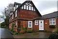
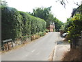
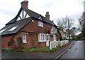
1
Water Lane junction with The St and Roundwell
Image: © Mark Anderson
Taken: 20 Dec 2022
0.02 miles
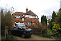
4
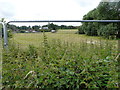
Field, The Street
Protected by a stout fence and stinging nettles!
Image: © John Baker
Taken: 17 Jun 2018
0.04 miles
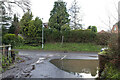
6
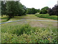
Field, The Street
The whole field is enclosed by a stout fence, while the delve in the ground marks where The Lilk flows.
Image: © John Baker
Taken: 17 Jun 2018
0.06 miles
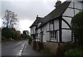
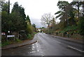
9
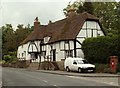
Old cottages at Bearsted
The main road here is called Roundwell and the turning just off to the right is called Sutton Street.
Image: © Robert Edwards
Taken: 12 Jun 2009
0.07 miles