IMAGES TAKEN NEAR TO
Scragged Oak Road, MAIDSTONE, ME14 3HD
Introduction
This page details the photographs taken nearby to Scragged Oak Road, ME14 3HD by members of the Geograph project.
The Geograph project started in 2005 with the aim of publishing, organising and preserving representative images for every square kilometre of Great Britain, Ireland and the Isle of Man.

There are currently over 7.5m images from over14,400 individuals and you can help contribute to the project by visiting https://www.geograph.org.uk
Image Map
Images are licensed for reuse under creativecommons.org/licenses/by-sa/2.0
Notes
- Clicking on the map will re-center to the selected point.
- The higher the marker number, the further away the image location is from the centre of the postcode.
Image Listing (7 Images Found)
Images are licensed for reuse under creativecommons.org/licenses/by-sa/2.0
Image
Details
Distance
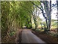
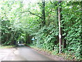
3
Footpath on Scragged Oak Road
KH73 leads to Cox Street via Stockings Wood.
Image: © David Anstiss
Taken: 5 Dec 2008
0.10 miles
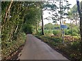
6
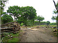
Forestry, Stockings Wood
Coppicing of what looks like mainly chestnut.
Image: © Robin Webster
Taken: 11 Jun 2016
0.20 miles