IMAGES TAKEN NEAR TO
Ringlestone Crescent, MAIDSTONE, ME14 2NE
Introduction
This page details the photographs taken nearby to Ringlestone Crescent, ME14 2NE by members of the Geograph project.
The Geograph project started in 2005 with the aim of publishing, organising and preserving representative images for every square kilometre of Great Britain, Ireland and the Isle of Man.

There are currently over 7.5m images from over14,400 individuals and you can help contribute to the project by visiting https://www.geograph.org.uk
Image Map
Images are licensed for reuse under creativecommons.org/licenses/by-sa/2.0
Notes
- Clicking on the map will re-center to the selected point.
- The higher the marker number, the further away the image location is from the centre of the postcode.
Image Listing (83 Images Found)
Images are licensed for reuse under creativecommons.org/licenses/by-sa/2.0
Image
Details
Distance
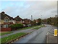
2

Footbridge over A229 Royal Engineers Road
Leads from Troodos Hill to Gibraltar Lane.
Image: © David Anstiss
Taken: 16 Dec 2008
0.02 miles
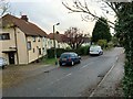
5
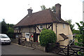
Sandling Place Farm, Chatham Road, Maidstone, Kent
Grade II* listed.
Image: © Oast House Archive
Taken: 14 Jun 2009
0.05 miles
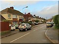
6

Royal Engineers Road
View from footbridge across Royal Engineers Road (A229) towards town.
Image: © Brigitt Vose
Taken: 13 May 2012
0.05 miles
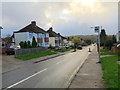
7
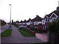
Chatham Road, Ringlestone
This quiet road used to be the A229.
Image: © Chris Whippet
Taken: 16 Nov 2009
0.09 miles