IMAGES TAKEN NEAR TO
James Whatman Way, MAIDSTONE, ME14 1LQ
Introduction
This page details the photographs taken nearby to James Whatman Way, ME14 1LQ by members of the Geograph project.
The Geograph project started in 2005 with the aim of publishing, organising and preserving representative images for every square kilometre of Great Britain, Ireland and the Isle of Man.

There are currently over 7.5m images from over14,400 individuals and you can help contribute to the project by visiting https://www.geograph.org.uk
Image Map
Images are licensed for reuse under creativecommons.org/licenses/by-sa/2.0
Notes
- Clicking on the map will re-center to the selected point.
- The higher the marker number, the further away the image location is from the centre of the postcode.
Image Listing (200 Images Found)
Images are licensed for reuse under creativecommons.org/licenses/by-sa/2.0
Image
Details
Distance
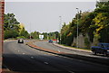
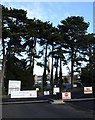
2
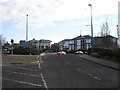
New office buildings, Maidstone
Near Springfield Mill, between the A229 and Image
Image: © Penny Mayes
Taken: 24 Dec 2005
0.07 miles
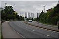
3
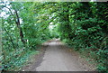
Path up to the Millennium Bridge, Maidstone
Image: © N Chadwick
Taken: 19 Sep 2009
0.07 miles
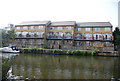
4
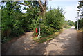
Springfield Mill, Maidstone
Entrance to the Whatman paper mill next to the Medway just north of the town centre.
Image: © Penny Mayes
Taken: 24 Dec 2005
0.07 miles
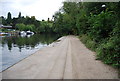
5
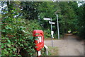
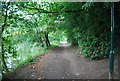
Signposts on the banks of the River Medway
Image: © N Chadwick
Taken: 19 Sep 2009
0.08 miles