IMAGES TAKEN NEAR TO
Scarborough Lane, ROCHESTER, ME1 3XU

Introduction

This page details the photographs taken nearby to Scarborough Lane, ME1 3XU by members of the Geograph project.

The Geograph project started in 2005 with the aim of publishing, organising and preserving representative images for every square kilometre of Great Britain, Ireland and the Isle of Man.

There are currently over 7.5m images from over14,400 individuals and you can help contribute to the project by visiting https://www.geograph.org.uk

Image Map


Images are licensed for reuse under creativecommons.org/licenses/by-sa/2.0
Notes
  • Clicking on the map will re-center to the selected point.
  • The higher the marker number, the further away the image location is from the centre of the postcode.

Image Listing (19 Images Found)

Images are licensed for reuse under creativecommons.org/licenses/by-sa/2.0
Image
Details
Distance
1
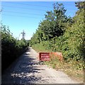
Entrance to Margett's Pit landfill
The Margett family owned the West Kent Portland Cement Company.
Image: © Dylan Moore Taken: 2 Apr 2014
0.03 miles
2
Scarborough Lane, Burham
Image: © Chris Whippet Taken: 8 Sep 2016
0.04 miles
3
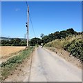
Margetts Lane, Burham
Image: © Chris Whippet Taken: 8 Sep 2016
0.07 miles
4
Pylon, near Old Church Rd
Image: © N Chadwick Taken: 15 Apr 2010
0.09 miles
5
Pylons near Margetts Lane
This line of pylons is parallel to Margetts Lane which is just on the right here. The River Medway is down the hill to the left.
Image: © Marathon Taken: 27 Jul 2022
0.10 miles
6
Pylons in the Medway Valley
This line of pylons is parallel to Margetts Lane which is just on the right here. The River Medway is down the hill to the left.
Image: © Marathon Taken: 27 Jul 2022
0.10 miles
7
Two pylons
Image: © N Chadwick Taken: 30 Aug 2011
0.12 miles
8
Houses, Scarborough Lane
Image: © N Chadwick Taken: 15 Apr 2010
0.18 miles
9
Pylons and farmland near Burham
Image: © N Chadwick Taken: 30 Aug 2011
0.19 miles
10
Mill Bay
House on New Court Road, first shown on the 1909 25 inch map, between two tramways taking chalk down to the West Kent Portland Cement Works (alternatively known as the Millbay works) situated by the River Medway, which closed in the 1920s. The route of the more northern of the two tramways is now Scarborough Lane.
Image: © Ian Capper Taken: 17 Feb 2022
0.19 miles