IMAGES TAKEN NEAR TO
High Street, ROCHESTER, ME1 3UT
Introduction
This page details the photographs taken nearby to High Street, ME1 3UT by members of the Geograph project.
The Geograph project started in 2005 with the aim of publishing, organising and preserving representative images for every square kilometre of Great Britain, Ireland and the Isle of Man.

There are currently over 7.5m images from over14,400 individuals and you can help contribute to the project by visiting https://www.geograph.org.uk
Image Map
Images are licensed for reuse under creativecommons.org/licenses/by-sa/2.0
Notes
- Clicking on the map will re-center to the selected point.
- The higher the marker number, the further away the image location is from the centre of the postcode.
Image Listing (80 Images Found)
Images are licensed for reuse under creativecommons.org/licenses/by-sa/2.0
Image
Details
Distance
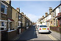
3
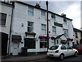
The Foresters Arms Pub, Wouldham
On High Street, opposite Ferry Lane.
Image: © David Anstiss
Taken: 21 Dec 2008
0.01 miles
5
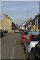
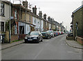
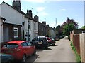
High Street, Wouldham
A somewhat narrower High Street than most.
Image: © Robin Webster
Taken: 4 Feb 2007
0.02 miles
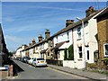
10
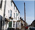
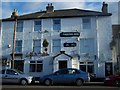
The Foresters Arms, High St, Wouldham
One of three pubs in the village.
Image: © N Chadwick
Taken: 15 Apr 2010
0.03 miles