IMAGES TAKEN NEAR TO
Whitstable Road, FAVERSHAM, ME13 9HT
Introduction
This page details the photographs taken nearby to Whitstable Road, ME13 9HT by members of the Geograph project.
The Geograph project started in 2005 with the aim of publishing, organising and preserving representative images for every square kilometre of Great Britain, Ireland and the Isle of Man.

There are currently over 7.5m images from over14,400 individuals and you can help contribute to the project by visiting https://www.geograph.org.uk
Image Map
Images are licensed for reuse under creativecommons.org/licenses/by-sa/2.0
Notes
- Clicking on the map will re-center to the selected point.
- The higher the marker number, the further away the image location is from the centre of the postcode.
Image Listing (16 Images Found)
Images are licensed for reuse under creativecommons.org/licenses/by-sa/2.0
Image
Details
Distance
3
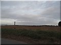
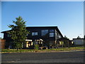
Yaldings Bed & Breakfast
This Georgian guesthouse stands on Staplestreet Road just north of the A299 Thanet Way. The recently felled poplars would have been planted as a windbreak for orchards or a hop garden and I imagine they also provided a sound baffle against traffic noise.
Image: © Penny Mayes
Taken: 11 Feb 2007
0.07 miles
7
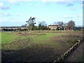
Dunster House, Goodnestone
In 2009 this was just fields. It is now a log cabin manufacturer. https://dunsterhouse.co.uk/
Image: © David Howard
Taken: 30 Jun 2018
0.09 miles
8
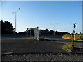
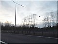
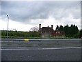
The A299 Margate road
The area to the right of the road was the car park for The Duke of Kent, a large roadside pub (just visible behind the weeping willow), now abandoned since the building of the dual carriageway made it less accessible.
Image: © David Long
Taken: 21 Apr 2006
0.10 miles
9
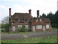
Fire damaged Duke of Kent Public House, Faversham
This public house has been closed for many years now. Planning permission to convert it was turned down recently. Then 'vandals' have attacked it and set fire to part of the property. With no roof the building will rot much quickly and then have to be demolished and then planning permission will be granted more easily.
Image: © David Anstiss
Taken: 13 Apr 2009
0.10 miles
10
Fire damaged Duke of Kent Public House, Faversham
Image: © Elliott Simpson
Taken: 28 Apr 2009
0.11 miles