1
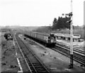
Green shed near Selling station
There was no sign to indicate what business is carried on here. Being adjacent to the railway line it might at one time have had a siding.
Image: © Stephen Craven
Taken: 31 Aug 2009
0.01 miles
2
New homes in Selling
A small development taking place near Oversland.
Image: © pam fray
Taken: 3 Sep 2015
0.02 miles
3
Houses under construction
Image: © Oast House Archive
Taken: 6 Apr 2015
0.02 miles
4
Railway bridge at Selling
This is an instance where the road has been lowered to go under the railway, rather than a bridge built over it. The sign indicates that the road can flood as a result.
Image: © Stephen Craven
Taken: 31 Aug 2009
0.03 miles
5
Fox Lane railway bridge
Looking towards Oversland.
Image: © pam fray
Taken: 3 Sep 2015
0.04 miles
6
Railway bridge near Selling Station
This section of the lane is subject to severe flooding and the water has only recently subsided since the last heavy rainfall.
Image: © pam fray
Taken: 20 Jan 2008
0.05 miles
7
Footpath beside the railway
This path (not show on many maps) leads from Oversland Road alongside the railway (on the lefthand side) to Selling Station.
Image: © David Anstiss
Taken: 24 Jun 2009
0.06 miles
8
Old siding at Selling station
The line from Faversham to Canterbury East was opened on 9th July 1860 by the London, Chatham & Dover Railway, and Selling station followed on 3rd December 1860. The original station was destroyed by fire in the early 1990s, shortly before it was to be made a listed building. The signal box which was here can now be seen at Eythorne station on the East Kent Light Railway.
This is the view from the end of the down platform towards the remains of an old siding which can be seen here, now lost amongst trees. The view of this from the footbridge at the station can be seen at http://www.geograph.org.uk/photo/3409957
Image: © Marathon
Taken: 12 Apr 2013
0.07 miles
9
SE of Selling Station
Electric multiple unit 7174 soon after departure from Selling Station heading for Canterbury
Image: © Rob Newman
Taken: Unknown
0.08 miles
10
View from the footbridge at Selling station
The line from Faversham to Canterbury East was opened on 9th July 1860 by the London, Chatham & Dover Railway, and Selling station followed on 3rd December 1860. The original station was destroyed by fire in the early 1990s, shortly before it was to be made a listed building. The signal box which was here can now be seen at Eythorne station on the East Kent Light Railway.
This is the view from the footbridge looking in the direction of Dover. The remains of an old siding can be seen on the left, now lost amongst trees.
Image: © Marathon
Taken: 12 Apr 2013
0.08 miles


