IMAGES TAKEN NEAR TO
Monkshill Road, FAVERSHAM, ME13 9EH
Introduction
This page details the photographs taken nearby to Monkshill Road, ME13 9EH by members of the Geograph project.
The Geograph project started in 2005 with the aim of publishing, organising and preserving representative images for every square kilometre of Great Britain, Ireland and the Isle of Man.

There are currently over 7.5m images from over14,400 individuals and you can help contribute to the project by visiting https://www.geograph.org.uk
Image Map
Images are licensed for reuse under creativecommons.org/licenses/by-sa/2.0
Notes
- Clicking on the map will re-center to the selected point.
- The higher the marker number, the further away the image location is from the centre of the postcode.
Image Listing (14 Images Found)
Images are licensed for reuse under creativecommons.org/licenses/by-sa/2.0
Image
Details
Distance
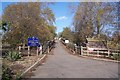
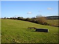
1
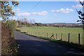
Monkshill Road
This narrow road leads from Graveney to Waterham and Highstreet.
Image: © David Anstiss
Taken: 26 Oct 2009
0.03 miles
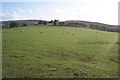
2
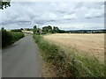
Monkshill Road
This looks towards Monkshill Farm in the distance.
Image: © Marathon
Taken: 25 Jun 2022
0.04 miles
3
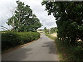
Monkshill Road
This looks towards Monkshill Farm in the distance.
Image: © Marathon
Taken: 25 Jun 2022
0.04 miles
5
Access road to Monkshill Farm
Seen from Monkshill Road. See Image for more details.
Image: © David Anstiss
Taken: 26 Oct 2009
0.10 miles
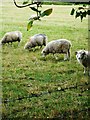
6
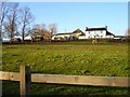
Monkshill Farm
The Royal School for Deaf Children's Farm is a 65 acre site which has sheep, cows, pigs, chickens, goats, rabbits and alpacas http://www.geograph.org.uk/photo/336620. It also provides livery for several horses.
Image: © Penny Mayes
Taken: 11 Feb 2007
0.11 miles
7
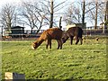
Alpacas
At Monkshill Farm http://www.geograph.org.uk/photo/336608 .
Image: © Penny Mayes
Taken: 11 Feb 2007
0.12 miles
8
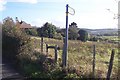
Footpath on Monkshill Road
This path leads through Horse Hill Farm (house seen in background) to Wey Street near the A299 Thanet Way. Monkshill Road leads to Waterham from Graveney.
Image: © David Anstiss
Taken: 26 Oct 2009
0.18 miles
9
Horse Hill Farm
The farm buildings are on the left (spot height 24 metres), Holly Hill (108m), in the distance on the right is in Image
Image: © Penny Mayes
Taken: 11 Feb 2007
0.18 miles
10
Horse Hill and Holly Hill
Seen from Monkshill Road. Horse Hill is on the right. Holly Hilly and Blean Woods in the background on the left.
Image: © David Anstiss
Taken: 26 Oct 2009
0.18 miles