
IMAGES TAKEN NEAR TO
Seasalter Road, FAVERSHAM, ME13 9ED
Introduction
This page details the photographs taken nearby to Seasalter Road, ME13 9ED by members of the Geograph project.
The Geograph project started in 2005 with the aim of publishing, organising and preserving representative images for every square kilometre of Great Britain, Ireland and the Isle of Man.

There are currently over 7.5m images from over14,400 individuals and you can help contribute to the project by visiting https://www.geograph.org.uk
Image Map
Images are licensed for reuse under creativecommons.org/licenses/by-sa/2.0
Notes
- Clicking on the map will re-center to the selected point.
- The higher the marker number, the further away the image location is from the centre of the postcode.
Image Listing (19 Images Found)
Images are licensed for reuse under creativecommons.org/licenses/by-sa/2.0
Image
Details
Distance
2
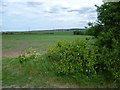
View from the road to Graveney Hill
Seasalter Road is on the other side of the field and the hills in the distance are beyond Thanet Way. The built-up area is Whitstable.
Image: © Marathon
Taken: 28 May 2015
0.06 miles
4
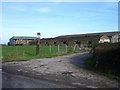
Barns at Denley Hill Farm
An unusual low brick building, with possible origins as a wartime pig unit. The gable appears to be semi-circular to take a corrugated iron roof. The spelling of the farm name differs from that of the hill as shown on the map.
Image: © Penny Mayes
Taken: 15 Feb 2007
0.07 miles
5
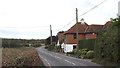
Seasalter Road, Graveney near Faversham
Seasalter Road forms part of National Cycle Network route 1, which links Dover with John o'Groats.
Image: © Malc McDonald
Taken: 26 Oct 2013
0.07 miles
6
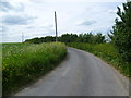
The road to Graveney Hill
Just north of Graveney, this road leads out past Graveney Hill and Cleve Hill to Graveney Marshes and Cleve Marshes.
Image: © Marathon
Taken: 28 May 2015
0.09 miles
8
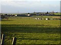
Denley Hill Farm
Seen from Horse Hill Farm with Graveney Hill (15m) rising behind it. The higher ground in the distance is the Isle of Sheppey. The difference in spelling between the hill and the farm is one of those cartographic oddities.
Image: © Penny Mayes
Taken: 11 Feb 2007
0.14 miles
9
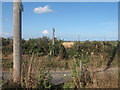
Footpath crosses road on Graveney Hill
This path is No.ZR488 leading from Broom Street, over Graveney Hill to Seasalter Road. The road leads left to Crown Cottages from Seasalter Road.
Image: © David Anstiss
Taken: 23 Jul 2009
0.14 miles
10
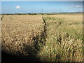
Footpath towards Seasalter Road
This is Path No.ZR488 leading from Broom Street, over Graveney Hill, and over Crown Cottages road. It now leads downhill towards the road. Seasalter / Whitstable is in the background on the far right.
Image: © David Anstiss
Taken: 23 Jul 2009
0.14 miles