IMAGES TAKEN NEAR TO
The Shipyard, Upper Brents, FAVERSHAM, ME13 7DZ
Introduction
This page details the photographs taken nearby to The Shipyard, Upper Brents, ME13 7DZ by members of the Geograph project.
The Geograph project started in 2005 with the aim of publishing, organising and preserving representative images for every square kilometre of Great Britain, Ireland and the Isle of Man.

There are currently over 7.5m images from over14,400 individuals and you can help contribute to the project by visiting https://www.geograph.org.uk
Image Map
Images are licensed for reuse under creativecommons.org/licenses/by-sa/2.0
Notes
- Clicking on the map will re-center to the selected point.
- The higher the marker number, the further away the image location is from the centre of the postcode.
Image Listing (321 Images Found)
Images are licensed for reuse under creativecommons.org/licenses/by-sa/2.0
Image
Details
Distance
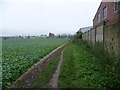
3
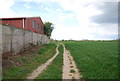
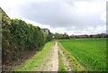
Saxon Shore Way, Faversham
Leading to Ham Marshes and Faversham Creek.
Image: © pam fray
Taken: 3 Apr 2020
0.05 miles
4
The Saxon Shore Way leading back to Faversham Creek
The Saxon Shore Way out of Faversham along the west side of Faversham Creek leaves the creek for a short distance to pass around The Brents housing estate and industrial estate before heading back to the creekside. Here the industrial estate is on the right hand side and the buildings in the centre are on the far side of Faversham Creek.
After a great deal of rain in the last day or so, the Saxon Shore Way from here was exceedingly muddy.
Image: © Marathon
Taken: 16 Nov 2014
0.06 miles
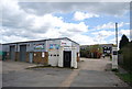
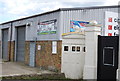
6
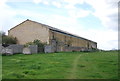
Large brick building on the edge of Faversham
Image: © N Chadwick
Taken: 22 Apr 2012
0.07 miles
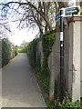
7
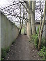
Footpath, Faversham
Between Waterside Close and Upper Brents.
Image: © pam fray
Taken: 3 Apr 2020
0.07 miles
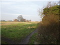
10
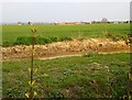
The Brents from Ham Road
The cutting in the foreground appears to be an access road, possibly for an extension of the gravel extraction works the other side of the road. In the distance, The Brents industrial estate (still in TR0162) and, on the left, the old warehouse on Faversham Creek is in Image
Image: © Penny Mayes
Taken: 9 Apr 2007
0.07 miles