IMAGES TAKEN NEAR TO
Bardell Terrace, ROCHESTER, ME1 1NG
Introduction
This page details the photographs taken nearby to Bardell Terrace, ME1 1NG by members of the Geograph project.
The Geograph project started in 2005 with the aim of publishing, organising and preserving representative images for every square kilometre of Great Britain, Ireland and the Isle of Man.

There are currently over 7.5m images from over14,400 individuals and you can help contribute to the project by visiting https://www.geograph.org.uk
Image Map
Images are licensed for reuse under creativecommons.org/licenses/by-sa/2.0
Notes
- Clicking on the map will re-center to the selected point.
- The higher the marker number, the further away the image location is from the centre of the postcode.
Image Listing (606 Images Found)
Images are licensed for reuse under creativecommons.org/licenses/by-sa/2.0
Image
Details
Distance
1
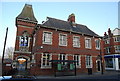
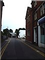
The Old Crown Court, Rochester High St
Now converted to a dental practise.
Image: © N Chadwick
Taken: 31 Jan 2009
0.02 miles
4
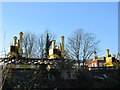
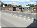
Track laying machine near Rochester
These are part of a set of track laying machines near the new Rochester station currently being built.
Image: © David Anstiss
Taken: 6 Dec 2014
0.03 miles
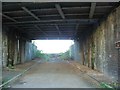
5
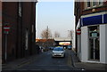
Looking down Furrells Rd to the railway bridge
Image: © N Chadwick
Taken: 31 Jan 2009
0.03 miles
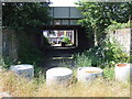
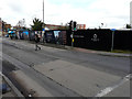
7
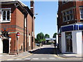
Peugeot Motorline, High Street
The growth of plants beyond the gate indicates that this franchise has moved elsewhere.
Image: © John Baker
Taken: 31 Jul 2018
0.03 miles
10
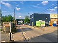
Bardell Wharf, High Street
Planning permission has been approved, with conditions, by Medway Council under application number MC/19/0038 for “residential - led mixed use development comprising 331 residential units, non-residential floor space comprising 1,894 sqm of Class A1, A2, A3, A5 and D2 floorspace associated car parking (258 car parking spaces and 8 on street spaces) landscaping, engineering works, highway works to the junction of Corporation Street and High Street and alterations to pedestrian crossing - including demolition of all buildings on site apart from the buildings east of Furrells Road fronting onto the High Street, which is proposed to be partially demolished”.
The development is a continuation of Image
Image: © John Baker
Taken: 26 Feb 2020
0.05 miles