IMAGES TAKEN NEAR TO
Harriet Drive, ROCHESTER, ME1 1DY
Introduction
This page details the photographs taken nearby to Harriet Drive, ME1 1DY by members of the Geograph project.
The Geograph project started in 2005 with the aim of publishing, organising and preserving representative images for every square kilometre of Great Britain, Ireland and the Isle of Man.

There are currently over 7.5m images from over14,400 individuals and you can help contribute to the project by visiting https://www.geograph.org.uk
Image Map
Images are licensed for reuse under creativecommons.org/licenses/by-sa/2.0
Notes
- Clicking on the map will re-center to the selected point.
- The higher the marker number, the further away the image location is from the centre of the postcode.
Image Listing (66 Images Found)
Images are licensed for reuse under creativecommons.org/licenses/by-sa/2.0
Image
Details
Distance
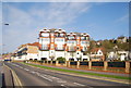
1
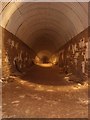
Shorts Brothers Tunnels, Rochester, Kent
On 23rd September 1941 Shorts Brothers contacted the Ministry of Aircraft Production regarding their seaplane works at Rochester seeking authority to build a new underground works in tunnels excavated under chalk cliffs behind their existing MAP extension factory on the south bank of the River Medway. Space was urgently required for 75 new machine tools as their works were full to capacity. The tunnels were intended to create 12,000 square feet of workshop space at a cost of £20,000 which, it was acknowledged was somewhat higher than a new surface building but stress was laid upon the vulnerability of the Medway estuary.
The project was given the go ahead and the tunnels were excavated consisting of two parallel tunnels, each one hundred metres in length, these were linked by four 75 metre long adits to the cliff face at the rear of the factory. The tunnels were for the most part cut from chalk and brick lined (one of the adits was unlined). There were also two 45 degree ventilation shafts extending to the surface.
Image: © rob
Taken: 1 Jan 2010
0.06 miles
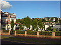
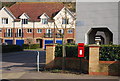
3
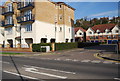
Sage Rd off The Esplanade
A modern riverside development.
Image: © N Chadwick
Taken: 15 Apr 2010
0.07 miles
5
Sage Road, Rochester
Viewed from The Esplanade.
Image: © Danny P Robinson
Taken: 20 May 2008
0.08 miles
7
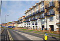
Apartment block, The Esplanade
A modern riverside development.
Image: © N Chadwick
Taken: 15 Apr 2010
0.09 miles
8
Apartment block, The Esplanade
A modern riverside development.
Image: © N Chadwick
Taken: 15 Apr 2010
0.09 miles
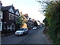
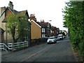
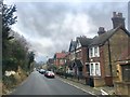
10
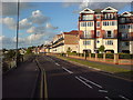
The Esplanade, Rochester (2)
Near Shelley Rise.
Image: © Danny P Robinson
Taken: 20 May 2008
0.10 miles