IMAGES TAKEN NEAR TO
Southdown Crescent, MANCHESTER, M9 7DQ

Introduction

This page details the photographs taken nearby to Southdown Crescent, M9 7DQ by members of the Geograph project.

The Geograph project started in 2005 with the aim of publishing, organising and preserving representative images for every square kilometre of Great Britain, Ireland and the Isle of Man.

There are currently over 7.5m images from over14,400 individuals and you can help contribute to the project by visiting https://www.geograph.org.uk

Image Map


Images are licensed for reuse under creativecommons.org/licenses/by-sa/2.0
Notes
  • Clicking on the map will re-center to the selected point.
  • The higher the marker number, the further away the image location is from the centre of the postcode.

Image Listing (23 Images Found)

Images are licensed for reuse under creativecommons.org/licenses/by-sa/2.0
  • ...
Image
Details
Distance
1
Boggart Hole Clough
The eastern end of the park, near to the boating lake.
Image: © David Dixon Taken: 9 Apr 2010
0.12 miles
2
A Balloon over White Moss Estate
Image: © Ray West Taken: 20 Sep 2006
0.14 miles
3
Post Office and shop on Charlestown Road
Image: © JThomas Taken: 25 Sep 2018
0.15 miles
4
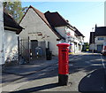
George V postbox on Charlestown Road, Charlestown
Outside the Post Office Postbox No. M9 531. See Image] for context.
Image: © JThomas Taken: 25 Sep 2018
0.15 miles
5
Post Office and shop on Charlestown Road, Charlestown
Showing position of Postbox No. M9 531. See Image] for postbox.
Image: © JThomas Taken: 25 Sep 2018
0.15 miles
6
Cycle route towards Moston
A path heading away from the park of Boggart Hole Clough towards Moston and marked by OS maps as a cycle route.
Image: © Kevin Waterhouse Taken: 27 Mar 2024
0.15 miles
7
Road barrier in Boggart Hole Clough
The car park for the facilities in the park has gates to prevent motorists from wider access
Image: © Kevin Waterhouse Taken: 27 Mar 2024
0.16 miles
8
St John Bosco Church
St John Bosco Church on Charlestown Road, Blackley.
Image: © David Dixon Taken: 9 Apr 2010
0.17 miles
9
Saint John Bosco Roman Catholic Church
On Charlestown Road.
Image: © JThomas Taken: 25 Sep 2018
0.18 miles
10
The cafe, Boggart Hole Clough, Manchester
Boggart Hole Clough occupies 190 acres. The word "clough" is a northern expression for a steep sided valley and the site has many by ravines and gullies within this remnant of ancient forest. In 2007 it was designated as a Local Nature Reserve. A Boggart is a mythological creature sometimes described as a "household fairy". Generally mischievous they are blamed for curdling the milk and playing tricks on people. They are thought to live under bridges, like trolls, on sharp bends in roads and, in this case, in woodland.
Image: © Tricia Neal Taken: 15 Nov 2011
0.18 miles
  • ...