1
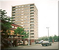
Harpurhey Shopper
The Harpurhey Shopper on Rochdale Road.
Image: © Peter McDermott
Taken: 25 Apr 2015
0.06 miles
2
Houses on Rochdale Road (A664), Manchester
Image: © JThomas
Taken: 17 Sep 2018
0.08 miles
3
Manchester General (Harpurhey) Cemetery
Manchester General Cemetery, now commonly referred to as Harpurhey Cemetery, is situated off Rochdale Road in North Manchester, next to Queen's Park. It is made up of both Non Conformist and Consecrated ground.
The Cemetery originally opened in 1837 and at the time, was privately owned, Manchester City Council acquired the cemetery around the 1960s.
Image: © David Dixon
Taken: 5 Mar 2014
0.08 miles
4
Rochdale Road (A664), Manchester
Looking north east.
Image: © JThomas
Taken: 17 Sep 2018
0.08 miles
5
Kingsbridge Court, Harpurhey Road
Kingsbridge Court from Harpurhey Road. The postal address of the block of flats - and of the maisonettes in the foreground - is Kingsbridge Road, yet there is no accessway to Kingsbridge Road!
Image: © Rob K Brettle
Taken: 11 Jun 2000
0.11 miles
6
Kingsbridge Court, Kingsbridge Road, Manchester
A thirteen-storey block containing 62 flats which was built around 1963.
Image: © Stephen Richards
Taken: 24 May 2016
0.11 miles
7
Rochdale Road
Buildings on Rochdale Road.
Image: © Peter McDermott
Taken: 17 Oct 2014
0.11 miles
8
Manchester General Cemetery
Image: © Peter McDermott
Taken: 10 May 2020
0.14 miles
9
Lodge, Rochdale Road, Manchester
Now in Queen's Park, but originally serving Hendham Hall (Hendleham in Pevsner) which was demolished in 1880. Derelict at the time and there is no sign of any improvement since.
Image: © Stephen Richards
Taken: 24 May 2016
0.14 miles
10
Cycle route descending to the River Irk
A view of Camelia Road with the walling of Manchester General Cemetery to the left
Image: © Kevin Waterhouse
Taken: 26 Apr 2023
0.15 miles


