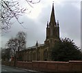
IMAGES TAKEN NEAR TO
Church Lane, MANCHESTER, M9 5BG

Introduction

This page details the photographs taken nearby to Church Lane, M9 5BG by members of the Geograph project.

The Geograph project started in 2005 with the aim of publishing, organising and preserving representative images for every square kilometre of Great Britain, Ireland and the Isle of Man.

There are currently over 7.5m images from over14,400 individuals and you can help contribute to the project by visiting https://www.geograph.org.uk

Image Map


Images are licensed for reuse under creativecommons.org/licenses/by-sa/2.0
Notes
  • Clicking on the map will re-center to the selected point.
  • The higher the marker number, the further away the image location is from the centre of the postcode.

Image Listing (31 Images Found)

Images are licensed for reuse under creativecommons.org/licenses/by-sa/2.0
  • ...
Image
Details
Distance
1
Harpurhey Market
Image: © Gerald England Taken: 24 Oct 2019
0.13 miles
2
Harpurhey Market
A (typically?) wet day at Harpurhey market. Harpurhey was formerly a centre of the dyeing industry. During the latter part of the 1900's the area became very rundown and neglected. Now, however, a great deal of regeneration work is taking place.
Image: © Keith Williamson Taken: 7 Apr 2005
0.13 miles
3
Christ Church
Image: © thejackrustles Taken: 18 Jul 2022
0.14 miles
4
The Jolly Miller
Disused public house.
Image: © Peter McDermott Taken: 2 Sep 2024
0.15 miles
5
Christ Church, Harpurhey
The south wall
Image: © David Dixon Taken: 9 Apr 2010
0.16 miles
6
Pollarded trees at Christ Church
The trees alongside the path to the church Image have been heavily pollarded.
Image: © Gerald England Taken: 1 Apr 2017
0.16 miles
7
Christ Church
Christ Church, Harpurhey.
Image: © Peter McDermott Taken: 10 May 2020
0.16 miles
8
Christ Church, Harpurhey
The tower and north wall, viewed from Church Lane.
Image: © David Dixon Taken: 9 Apr 2010
0.16 miles
9
Christ Church, Harpurhey
Christ Church was built on land donated in 1836 by Robina Andrew of the Green Mount Estate. The foundation stone was laid on 10 July 1837 and the church consecrated on 24 Sept. 1838. It was assigned a District as Christ Church, Harpurhey cum Moston, by Bishop's Instrument, 14 Feb 1839. It is a Grade II listed building http://www.britishlistedbuildings.co.uk/101197760-christ-church-harpurhey-ward
Image: © Gerald England Taken: 1 Apr 2017
0.16 miles
10
Christ Church, Harpurhey
Viewed from Rochdale Road.
Image: © David Dixon Taken: 9 Apr 2010
0.16 miles
  • ...