IMAGES TAKEN NEAR TO
Hassop Avenue, SALFORD, M7 3HB
Introduction
This page details the photographs taken nearby to Hassop Avenue, M7 3HB by members of the Geograph project.
The Geograph project started in 2005 with the aim of publishing, organising and preserving representative images for every square kilometre of Great Britain, Ireland and the Isle of Man.

There are currently over 7.5m images from over14,400 individuals and you can help contribute to the project by visiting https://www.geograph.org.uk
Image Map
Images are licensed for reuse under creativecommons.org/licenses/by-sa/2.0
Notes
- Clicking on the map will re-center to the selected point.
- The higher the marker number, the further away the image location is from the centre of the postcode.
Image Listing (10 Images Found)
Images are licensed for reuse under creativecommons.org/licenses/by-sa/2.0
Image
Details
Distance
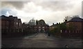
1
South Radford Street
Looking along South Radford Street from the Flood Levees on Littleton Road Playing Fields.
Image: © Edward Smith
Taken: 22 Jun 2007
0.08 miles
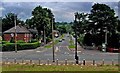
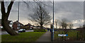
2
Matlock Avenue/Calton Avenue crossroads
Calton Avenue goes across in this image.
Image: © Bradley Michael
Taken: 18 Nov 2015
0.12 miles
4
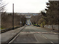
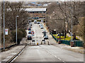
Oaklands Road, Kersal
Looking down Oaklands Road from castle Hill, towards Kersal Vale
Image: © David Dixon
Taken: 24 Feb 2011
0.18 miles
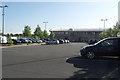
5
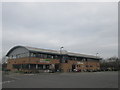
Kersal, Oaklands Road
Looking down Oaklands Road. The large building at the bottom (on the opposite side of Kersal Vale Road) is part of Salford Sports Village.
Image: © David Dixon
Taken: 24 Feb 2011
0.18 miles
7
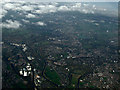
Prestwich from the air
The River Irwell can be seen meandering through the scene.
Image: © Thomas Nugent
Taken: 10 Nov 2014
0.19 miles
8
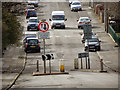
Kersal, Oaklands Road Chicane
The traffic-calming chicane on Oaklands Road, Kersal.
Image: © David Dixon
Taken: 24 Feb 2011
0.21 miles
10
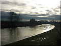
River Irwell at Kersal
Taken beside the footbridge over the River Irwell at Kersal Dale, I am looking south towards Pendleton and the Crescent in central Salford. The water level has receded considerably following the Boxing Day deluge brought by Storm Frank.
Image: © Carroll Pierce
Taken: 27 Dec 2015
0.25 miles