IMAGES TAKEN NEAR TO
Trafalgar Grove, SALFORD, M7 1XA
Introduction
This page details the photographs taken nearby to Trafalgar Grove, M7 1XA by members of the Geograph project.
The Geograph project started in 2005 with the aim of publishing, organising and preserving representative images for every square kilometre of Great Britain, Ireland and the Isle of Man.

There are currently over 7.5m images from over14,400 individuals and you can help contribute to the project by visiting https://www.geograph.org.uk
Image Map
Images are licensed for reuse under creativecommons.org/licenses/by-sa/2.0
Notes
- Clicking on the map will re-center to the selected point.
- The higher the marker number, the further away the image location is from the centre of the postcode.
Image Listing (35 Images Found)
Images are licensed for reuse under creativecommons.org/licenses/by-sa/2.0
Image
Details
Distance
2
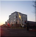
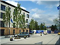
New Apartments - Great Clowes Street, Salford
Image: © Anthony Parkes
Taken: 7 Mar 2011
0.06 miles
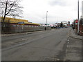
6
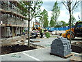
Tree planting
They were busy planting these 25ft trees with a crane and then raising them up by brute force.
Image: © Alexander P Kapp
Taken: 21 May 2007
0.09 miles
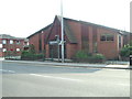
8
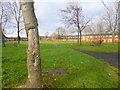
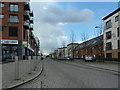
Broughton, open space
Off Bramley Street.
Image: © Mike Faherty
Taken: 26 Dec 2013
0.09 miles
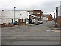
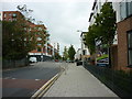
9
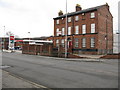
Lower Broughton - Old & New on Great Clowes Street
The older building stands on the corner of Kent Street.
Image: © Peter Whatley
Taken: 28 Feb 2009
0.09 miles