1
Cromwell Secondary School
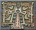
The derelict remains of Cromwell Secondary School including the 'Tree of Knowledge' mural.
Image: © Peter McDermott
Taken: 23 Jun 2019
0.02 miles
2
Irwell Valley, Salford
The location of the former Irwell Valley campus of the University of Salford, on Blandford Road, Salford, in Greater Manchester, England.
The building that was once here dated back to 1962, when it opened up as the Cromwell Secondary School for Girls. I understand it was later rebranded as the Irwell Valley High School. It must have changed hands around the turn of the millennium, as the University of Salford housed its art and design programme here between 2001 and 2007/2008. The building was identified for closure by the university, and in 2009 demolition began.
In this photo the university's welcome sign still remains, but the building is gone.
Image: © Steven Haslington
Taken: 26 Nov 2010
0.03 miles
3
Salford's Tree Of Knowledge
A Ceramic and Tiled Mural designed by Alan Boyson and adorned the gable end of Cromwell Secondary School.
It has just be Grade II listed by English Heritage.
Image: © Edward Smith
Taken: 7 May 2007
0.05 miles
4
Secret gardens of Welford Street (west)
The secret gardens in the back alleys of Welford Street have existed for many years, but were limited to permanent structures, difficult to steal or vandalise. The regeneration of Charlestown resulted in Welford Street's alley gates, which allowed an existing gardening community to flourish, particularly to the west end of the street.
Image: © Salford Sal
Taken: 28 Jul 2009
0.06 miles
5
Welford Street
Terraced housing with cobbled road, the stereotype for Salford
Image: © Kevin Waterhouse
Taken: 4 Jul 2023
0.07 miles
6
Secret gardens of Welford Street (East)
The regeneration of Charlestown resulted in Welford Street's alley gates, and a communal patio and potted garden appearing in the back alley.
Image: © Salford Sal
Taken: 28 Jul 2009
0.07 miles
7
The Houston, Pendleton
Image: © Alexander P Kapp
Taken: 15 Aug 2007
0.11 miles
8
Former Pendleton Co-operative building at Charlestown
Image: © John Slater
Taken: 14 Mar 2015
0.11 miles
9
Former Pendleton Co-operative building at Charlestown
Image: © John Slater
Taken: 14 Mar 2015
0.11 miles
10
Charlestown
The former Pendleton Co-operative building in Charlestown.
Image: © Peter McDermott
Taken: 12 Nov 2016
0.11 miles


