1
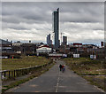
Hampson Street
Looking down Hampson Street, now subsumed by the Middlewood Locks development.
Image: © Peter McDermott
Taken: 27 Nov 2016
0.03 miles
2
Middlewood Street
On the right is the Middlewood Locks Development http://www.middlewood-locks.co.uk/ On the left is the Fusion Apartments https://julietwist.co.uk/developments/salford-manchester/fusion-manchester/fusion/
Image: © Gerald England
Taken: 15 Jun 2017
0.03 miles
3
Middlewood Locks Development
Construction site for the Middlewood Locks Development http://www.middlewood-locks.co.uk/
Image: © Gerald England
Taken: 15 Jun 2017
0.03 miles
4
Manchester : Salford - Wasteland
Looking across some derelict land off of Oldfield Road.
Image: © Lewis Clarke
Taken: 11 Oct 2014
0.04 miles
5
Hampson Street
The B5225, Hampson Street in Salford with Manchester City Centre in the background.
Image: © Peter McDermott
Taken: 26 Mar 2016
0.04 miles
6
Middlewood Locks
The Middlewood Locks site being developed by FairBriar International, a joint venture between Scarborough, Top Spring International Holdings Limited, a Hong Kong-listed real estate developer, and Metro Holdings Limited, a Singapore-listed property development and investment group.
Image: © Peter McDermott
Taken: 1 Oct 2016
0.05 miles
7
Salford
New advertising sign being prepared for installation.
http://www.manchestereveningnews.co.uk/news/greater-manchester-news/council-hit-jackpot-advertising-arch-7050073
Image: © Peter McDermott
Taken: 8 Aug 2015
0.05 miles
8
Work progresses
Roughly a year after the photo in the link below work has progressed well on the restoration of this small section of the Manchester, Bolton and Bury Canal. This work was being carried out as part of a regeneration project for the area and was linked to the construction of waterside living accommodation. The recent economic downturn has, however, seen the building developments in the area being put on hold for the time being. See
Image
Image: © Keith Williamson
Taken: 21 Nov 2008
0.05 miles
9
Manchester
View of Manchester seen from the junction of Oldfield Road and Middlewood Street.
Image: © Peter McDermott
Taken: 8 Aug 2015
0.05 miles
10
Manchester, Bolton and Bury Canal
The major part of this canal was constructed and operational during the 1790s, mainly carrying coal from the area it served into Manchester and Salford. As the 19th century closed the coal mines became worked out and canal traffic fell away. The canal suffered a number of serious breaches and it eventually fell into disuse,closing in 1961. The link from Oldfield Road to the River Irwell (joining this canal to the greater network), part of which is seen here, was completed in 1808. Following closure it was infilled in 1969. Plans to restore the canal are now in place and this section was excavated in 2006/7 in preparation for the building of a canalside housing development. Beyond the canal is part of the Manchester skyline, dominated by the slender Beetham Tower hotel and apartment complex.
Image: © Keith Williamson
Taken: 30 Sep 2007
0.05 miles


