IMAGES TAKEN NEAR TO
Aubrey Street, SALFORD, M50 3UT
Introduction
This page details the photographs taken nearby to Aubrey Street, M50 3UT by members of the Geograph project.
The Geograph project started in 2005 with the aim of publishing, organising and preserving representative images for every square kilometre of Great Britain, Ireland and the Isle of Man.

There are currently over 7.5m images from over14,400 individuals and you can help contribute to the project by visiting https://www.geograph.org.uk
Image Map
Images are licensed for reuse under creativecommons.org/licenses/by-sa/2.0
Notes
- Clicking on the map will re-center to the selected point.
- The higher the marker number, the further away the image location is from the centre of the postcode.
Image Listing (133 Images Found)
Images are licensed for reuse under creativecommons.org/licenses/by-sa/2.0
Image
Details
Distance


10
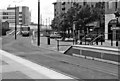
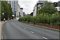
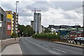
Manchester Metrolink - the descent to Anchorage
In the Salford Quays area, there is a long elevated section of the Manchester Metrolink. This section descends to ground level near the Anchorage tram stop, part of which can be seen in the foreground.
Image: © P L Chadwick
Taken: Unknown
0.11 miles