IMAGES TAKEN NEAR TO
Eckersley Fold Lane, MANCHESTER, M46 0RQ
Introduction
This page details the photographs taken nearby to Eckersley Fold Lane, M46 0RQ by members of the Geograph project.
The Geograph project started in 2005 with the aim of publishing, organising and preserving representative images for every square kilometre of Great Britain, Ireland and the Isle of Man.

There are currently over 7.5m images from over14,400 individuals and you can help contribute to the project by visiting https://www.geograph.org.uk
Image Map
Images are licensed for reuse under creativecommons.org/licenses/by-sa/2.0
Notes
- Clicking on the map will re-center to the selected point.
- The higher the marker number, the further away the image location is from the centre of the postcode.
Image Listing (7 Images Found)
Images are licensed for reuse under creativecommons.org/licenses/by-sa/2.0
Image
Details
Distance
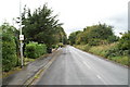
2
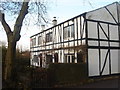
Cottages on Old Hall Mill Lane, Atherleigh
Image: © Margaret Clough
Taken: 12 Jan 2006
0.21 miles
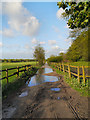
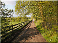
7
The Long Causeway, near Atherton Hall
A lane running across a network of fields between Leigh and Atherton, near Atherton Hall.
Image: © Margaret Clough
Taken: 12 Jan 2006
0.23 miles