IMAGES TAKEN NEAR TO
Stand Avenue, MANCHESTER, M45 7NW
Introduction
This page details the photographs taken nearby to Stand Avenue, M45 7NW by members of the Geograph project.
The Geograph project started in 2005 with the aim of publishing, organising and preserving representative images for every square kilometre of Great Britain, Ireland and the Isle of Man.

There are currently over 7.5m images from over14,400 individuals and you can help contribute to the project by visiting https://www.geograph.org.uk
Image Map
Images are licensed for reuse under creativecommons.org/licenses/by-sa/2.0
Notes
- Clicking on the map will re-center to the selected point.
- The higher the marker number, the further away the image location is from the centre of the postcode.
Image Listing (106 Images Found)
Images are licensed for reuse under creativecommons.org/licenses/by-sa/2.0
Image
Details
Distance
1
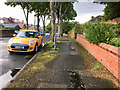
Benchmark at the high point of the road
This photo is taken from the very northern edge of SD8005, looking along Ashbourne Grove in SD 8006. This is just about the high point of the road, and there is a cut benchmark Image on the wall to the right. Perhaps it is in the place it is because this is the high point.
Image: © Neville Goodman
Taken: 18 Aug 2017
0.10 miles
2
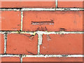
Partly filled in benchmark
The OS description is WALL NO10 ASHBOURNE GROVE SW FACE AT FENCE JUNC. Ashbourne Grove is shown in Image The mark is on the boundary between numbers 12 and 10, just slightly to the right, which is 10. Someone, when repointing the wall, has filled in the vertical section of the arrow.
Image: © Neville Goodman
Taken: 18 Aug 2017
0.10 miles
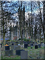
3
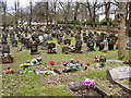
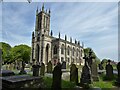
All Saints Graveyard
The graveyard at All Saints Parish Church
Image: © David Dixon
Taken: 6 Mar 2010
0.10 miles
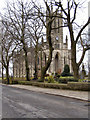
4

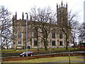
All Saint's Church, Stand, Whitefield
Situated on the northern edge of this grid square.
Image: © Keith Williamson
Taken: 18 Jan 2006
0.11 miles
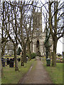
7
The Parish Church of All Saints, Stand
All Saints' Church on Church Lane at Stand.
Image: © David Dixon
Taken: 23 Dec 2012
0.11 miles
9
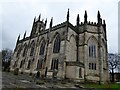
Stand Parish Church
Church of England Grade 1 listed parish church dedicated to All Saints. Building of the church commenced in 1821.
Image: © philandju
Taken: 25 Jan 2016
0.12 miles
10
Church of All Saints
The Parish Church of All Saints, Stand
Image: © Kevin Waterhouse
Taken: 14 May 2023
0.12 miles