IMAGES TAKEN NEAR TO
Woolden Road, MANCHESTER, M44 5JX
Introduction
This page details the photographs taken nearby to Woolden Road, M44 5JX by members of the Geograph project.
The Geograph project started in 2005 with the aim of publishing, organising and preserving representative images for every square kilometre of Great Britain, Ireland and the Isle of Man.

There are currently over 7.5m images from over14,400 individuals and you can help contribute to the project by visiting https://www.geograph.org.uk
Image Map
Images are licensed for reuse under creativecommons.org/licenses/by-sa/2.0
Notes
- Clicking on the map will re-center to the selected point.
- The higher the marker number, the further away the image location is from the centre of the postcode.
Image Listing (10 Images Found)
Images are licensed for reuse under creativecommons.org/licenses/by-sa/2.0
Image
Details
Distance
1
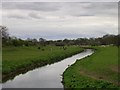
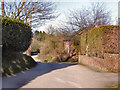
Glaze Brook
Glaze Brook (also known as the River Glaze) flows in a southerly direction across Chat Moss. Formerly a tributary of the Mersey, it now flows into the Manchester Ship Canal about 2km beyond this point. Photo taken from SJ 693 934.
Image: © Keith Williamson
Taken: 11 Apr 2005
0.05 miles
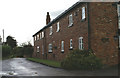
2
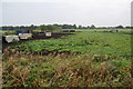
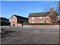
Pig farming on Great Woolden Moss
This is on the north side of Woolden Road. Much of the land here is devoted to horses.
Image: © Bill Boaden
Taken: 2 Oct 2011
0.09 miles
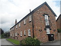
3
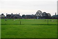
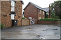
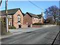
Great Woolden Hall
A centre for equestrianism.
Image: © Bill Boaden
Taken: 2 Oct 2011
0.12 miles