IMAGES TAKEN NEAR TO
Zinnia Drive, MANCHESTER, M44 5DP
Introduction
This page details the photographs taken nearby to Zinnia Drive, M44 5DP by members of the Geograph project.
The Geograph project started in 2005 with the aim of publishing, organising and preserving representative images for every square kilometre of Great Britain, Ireland and the Isle of Man.

There are currently over 7.5m images from over14,400 individuals and you can help contribute to the project by visiting https://www.geograph.org.uk
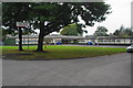
Image Map
Images are licensed for reuse under creativecommons.org/licenses/by-sa/2.0
Notes
- Clicking on the map will re-center to the selected point.
- The higher the marker number, the further away the image location is from the centre of the postcode.
Image Listing (19 Images Found)
Images are licensed for reuse under creativecommons.org/licenses/by-sa/2.0
Image
Details
Distance
2
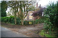
Upton Rose Farm
It is closed and boarded up, but there are workers on site so somebody must have some plans for this.
Image: © Bill Boaden
Taken: 2 Oct 2011
0.18 miles
4
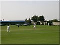
Cricket at the Steelworks
Cricket on the pitch at Irlam Steelworks Recreation and Social Club - Few reminders remain of the large steelworks that once dominated this town to the west of Manchester; this club and roads on the industrial estate that occupies the steelworks site, named after pioneers of the iron and steel industry, are examples. SJ716938.
Image: © Keith Williamson
Taken: 3 Sep 2005
0.21 miles
5
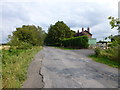
Irlam old fire station
Irlam old fire station, Clarendon Road, Irlam, Greater Manchester
Image: © Kevin Hale
Taken: 30 Oct 2007
0.21 miles
6
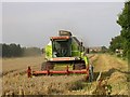
Harvesting
A closer view of the harvesting machine.
Image: © Keith Williamson
Taken: 3 Sep 2005
0.21 miles
7
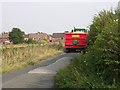
Carting it away!
A tractor taking away a loaded trailer full of recently harvested grain. Roscoe Road, Irlam.
Image: © Keith Williamson
Taken: 3 Sep 2005
0.21 miles
8
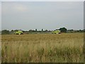
Ere the Winter Storms Begin
An earlier submission showed this field of wheat, now, a day later, the harvest has begun.
Image: © Keith Williamson
Taken: 3 Sep 2005
0.21 miles
9
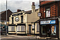
Railway Inn
The Railway Inn public house in Irlam.
Image: © Peter McDermott
Taken: 14 Jun 2017
0.22 miles
10
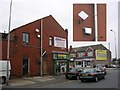
Squarial in Irlam
These "square" satellite dishes were used by British Satellite Broadcasting, the competitor to Sky before their merger. I have previously posted a picture to Image thinking I'd spotted one in Gorton, but the true nature of the item was called into doubt. I'm no longer sure it was the genuine article! This is - it bears the BSB logo and points in the right direction. Location is corner of Astley Road and Liverpool Road, Irlam. SJ716935
Image: © Keith Williamson
Taken: 7 Oct 2005
0.22 miles